


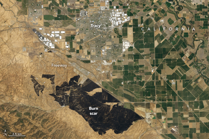
Grass Fire Chars California
Strong winds and ample fuel helped spread flames over 14,000 acres of grassland in San Joaquin County. View the full story
Image Credit: NASA Earth Observatory / Wanmei Liang
- X
https://science.nasa.gov/image-detail/corralfire-oli2-20240602/
TakenJune 2, 2024
Image CreditNASA Earth Observatory / Wanmei Liang
Size720x480px