


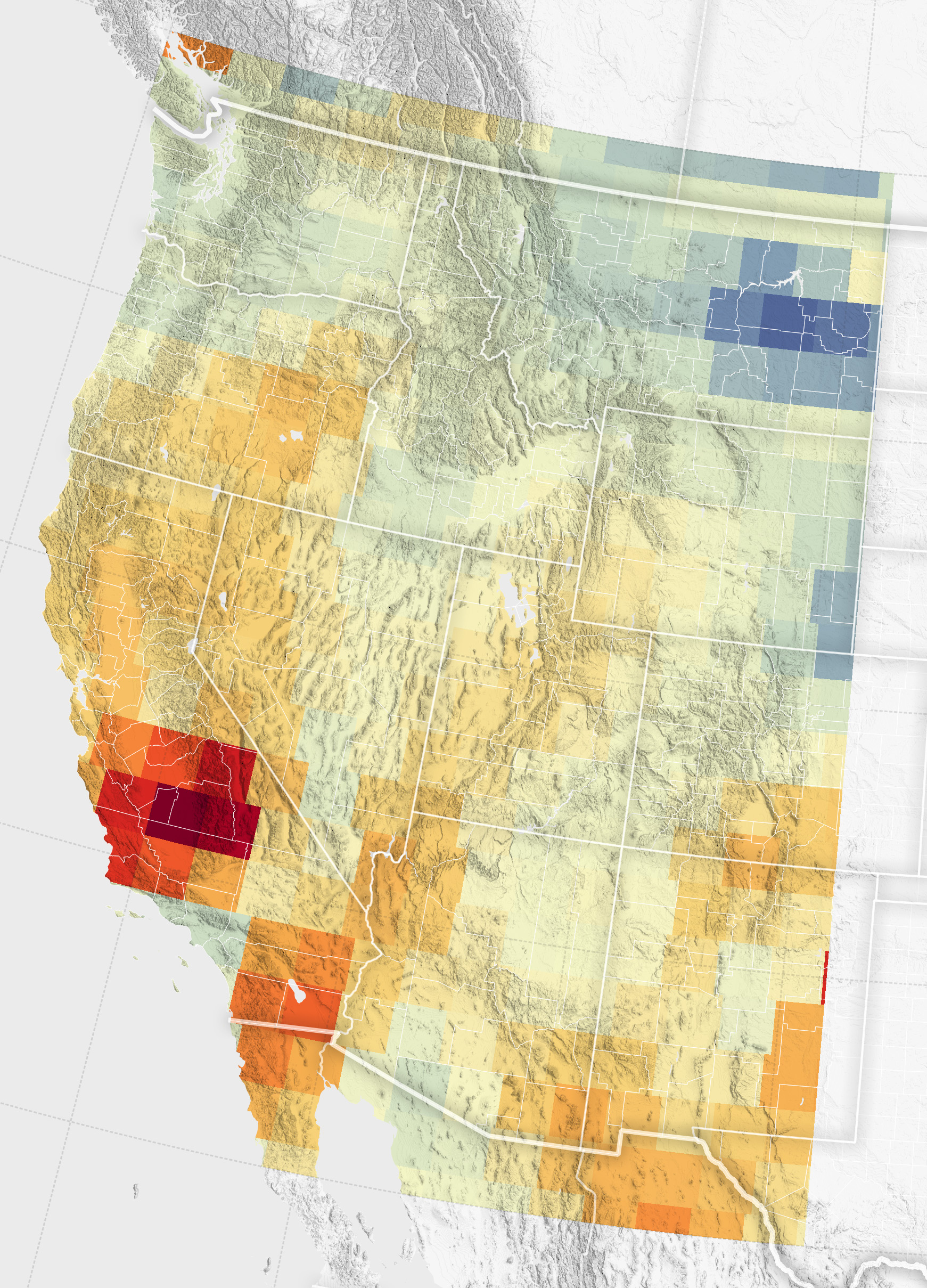
Groundwater Declines in the U.S. Southwest
Record snowfall has not been enough to offset groundwater losses amid long-term drying and a heightened demand for the resource. View the full story
Image Credit: NASA Earth Observatory / Wanmei Liang
- X
https://science.nasa.gov/image-detail/groundwater-grace-2023-lrg/
Image CreditNASA Earth Observatory / Wanmei Liang
Size1024x1422px