


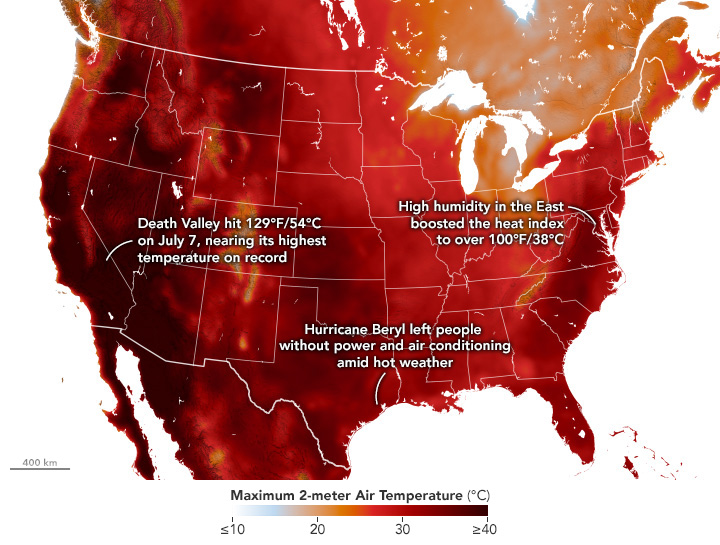
Extreme Heat Hammers U.S. Coasts
As summer heat hit the western and eastern U.S. in July 2024, temperatures have been especially high in the Southwest. View the full story
Image Credit: NASA Earth Observatory / Wanmei Liang
- X
https://science.nasa.gov/image-detail/heatwave-geos5-20240710/
TakenJuly 10, 2024
Image CreditNASA Earth Observatory / Wanmei Liang
Size720x545px