Europa ‘Ice Rafts’ in Local and Color Context
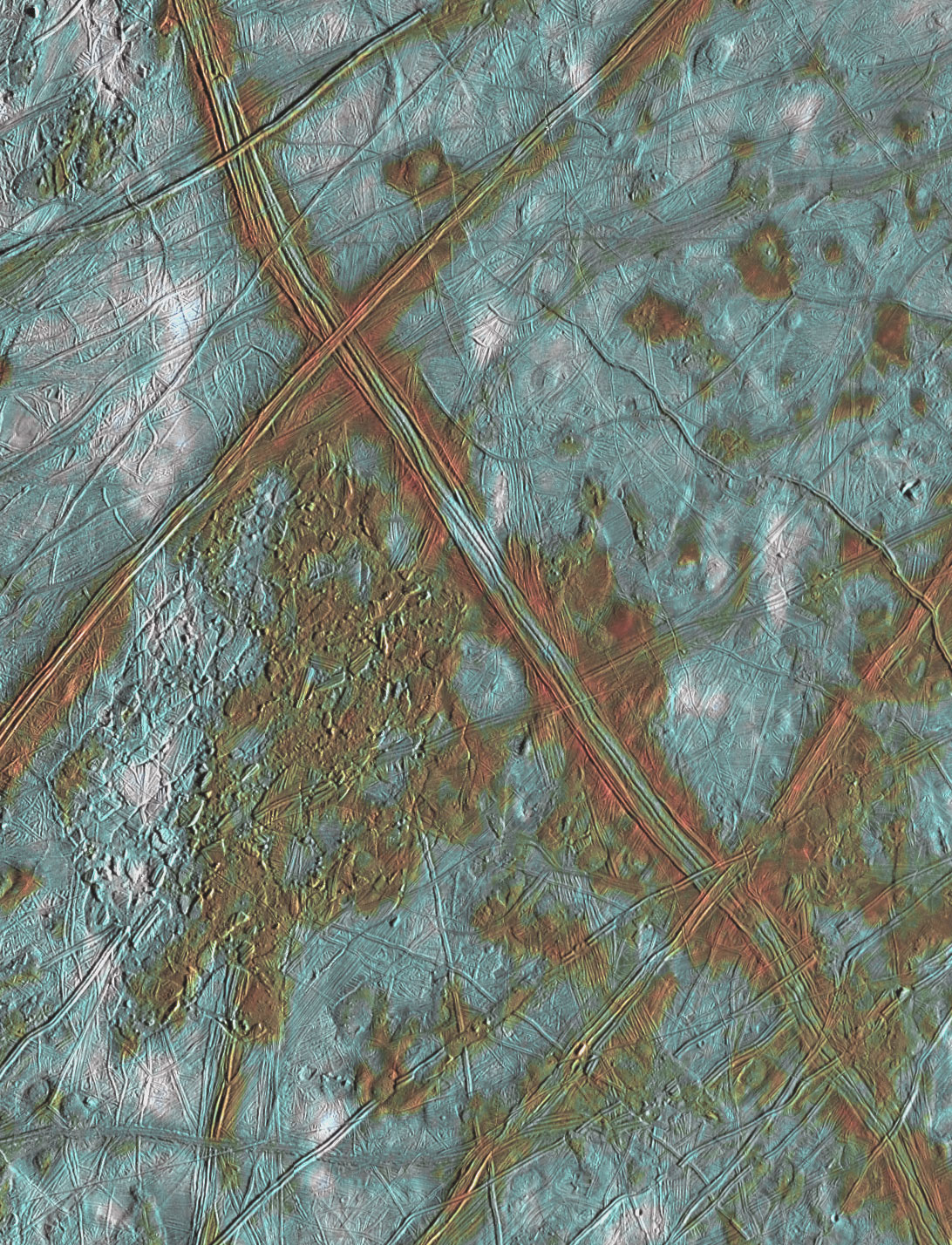
This mosaic of Europa was created using images taken by NASA's Galileo spacecraft in 1996 and 1997. It shows surface features such as domes and ridges, as well as a region of disrupted terrain including crustal plates which are thought to have broken apart and "rafted" into new positions. The added color allows the surface to be divided into three distinct spectral units. The bright white areas are ejecta rays from the relatively young crater Pwyll. Also visible are reddish areas which correspond to locations where non-ice components are present. The third distinct color is bright blue, and corresponds to the relatively old icy plains. This mosaic combines data taken by the Solid State Imaging (SSI) system on NASA's Galileo spacecraft during three separate flybys of Europa. Low resolution color data (violet, green, and 1 micron) acquired in September 1996 was combined with medium resolution images from December 1996, to produce synthetic color images. These were then combined with a high resolution mosaic of images acquired in February 1997.
- X


