Suggested Searches

Satellite image cutout of the Southwest United States and Northwest Mexico with state borders superimposed in white. The image is color coded from a pale blue to deep, near-black shade of red. The entire map appears to be on the red shade of the spectrum, with the lightest showing light yellow at the peak of the Rocky Mountains in Colorado. The deepest reds run through the California Valley and expand further inland as the valley gives way to mountains at the south. Deep blackish reds blanket phoenix and Las Vegas, with New Mexico and Texas appearing primarily in dark shades as well.

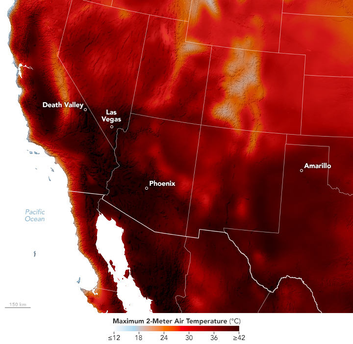
Heat Scorches U.S. Southwest

An early summer heat wave broke temperature records in Nevada, Arizona, and California in June 2024. View the full story

Image Credit: NASA Earth Observatory / Michala Garrison
Download