


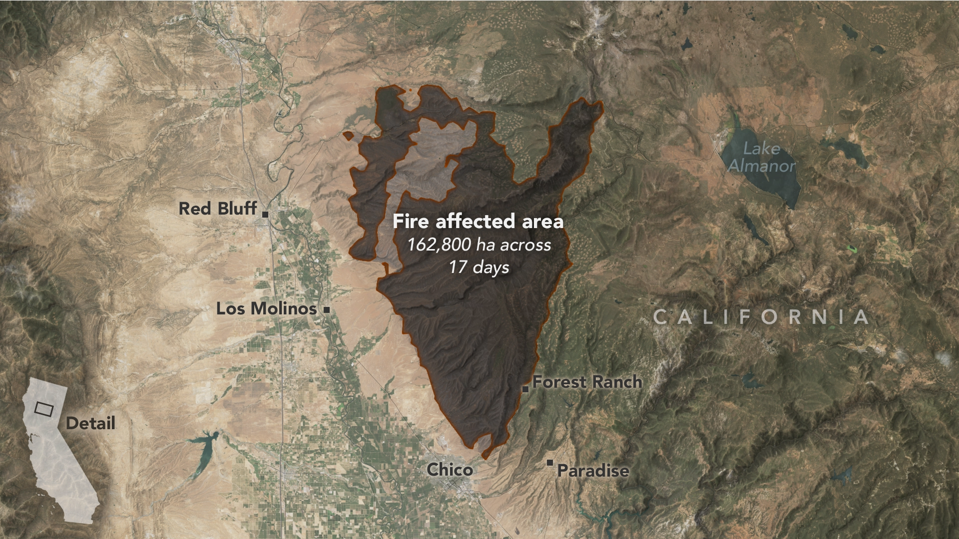
California’s Park Fire Spread Fast and Hot
An array of satellite sensors observed the long-duration, episodic spread of the state’s historic fire. View the full story
Image Credit: NASA Earth Observatory/Michala Garrison
- X
https://science.nasa.gov/image-detail/videoframe-40152/
TakenAugust 10, 2024
Image CreditNASA Earth Observatory/Michala Garrison
Size1024x576px