In Norwich, Vermont, the Montshire Museum of Science has been engaging a group of high school students from many corners of Vermont and New Hampshire in hands-on workforce development training geared toward addressing the unfolding challenges presented by climate change. The Montshire is a founding member of the network of science centers who are part of Learning Ecosystems Northeast, a NASA Science Activation project that supports peer communities of educators engaging youth in investigations of climate change.
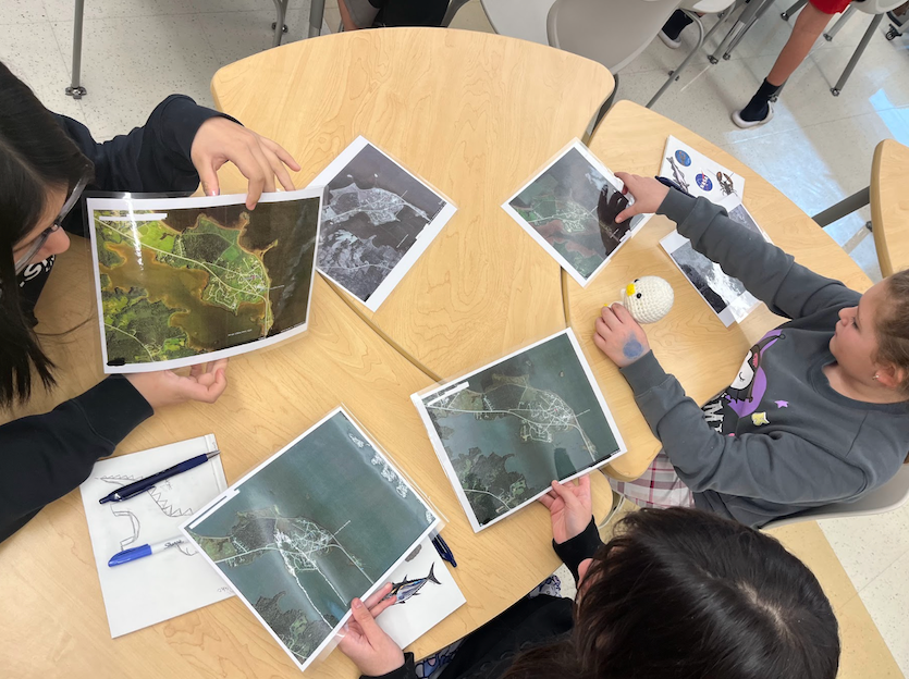
In Fall 2023, a group of eight 9th-12th grade Youth Leaders for Climate Action harvested vegetables while learning about sinking carbon into the soil of regenerative farms; collected water quality data with local monitoring groups; and learned to measure forest health through a variety of monitoring protocols, assisted by a local Land Conservancy. Youth are experiencing how the Land Cover Tool in the Global Learning and Observation to Benefit the Enviornment (GLOBE) Program's GLOBE Observer App can be used for "ground truthing" satellite data and building strong data sets that might later become raw input for models, Geospatial Information Systems (GIS) layers, or further geospatial data collection. The Youth Leaders enjoy both aspects of the seemingly juxtaposing data entry (heading out into the forest to closely assess the trees present) and the outcomes of data entry (looking at their forest on the global scale). Looking ahead, Montshire plans to integrate GLOBE soil data and air quality protocols into the work to complement field studies in those areas.
The GLOBE 'Land Cover' protocol has given our Youth Leaders a unifying praxis, helping them to understand the potential relationship between the Geographic Information Systems software we typically employ to study large trends and the field methods we use to study small, randomly positioned plots on the land.

Michael Loots
Climate Educator, Montshire Museum of Science
Learning Ecosystems Northeast is supported by NASA under cooperative agreement award number NNX16AB94A and is part of NASA’s Science Activation Portfolio.