Landsat 8 / LDCM Stories

NASA Open Science Initiative Expands OpenET Across Amazon Basin  

2 min read

The research teams who help sustain the largest freshwater reserve in the world are developing a new tool to promote more resilient farming systems in Brazil. The goal is to help farmers better handle changes in the water cycle, deal…

Article5 months ago

Evapotranspiration: Watching Over Water Use

3 min read

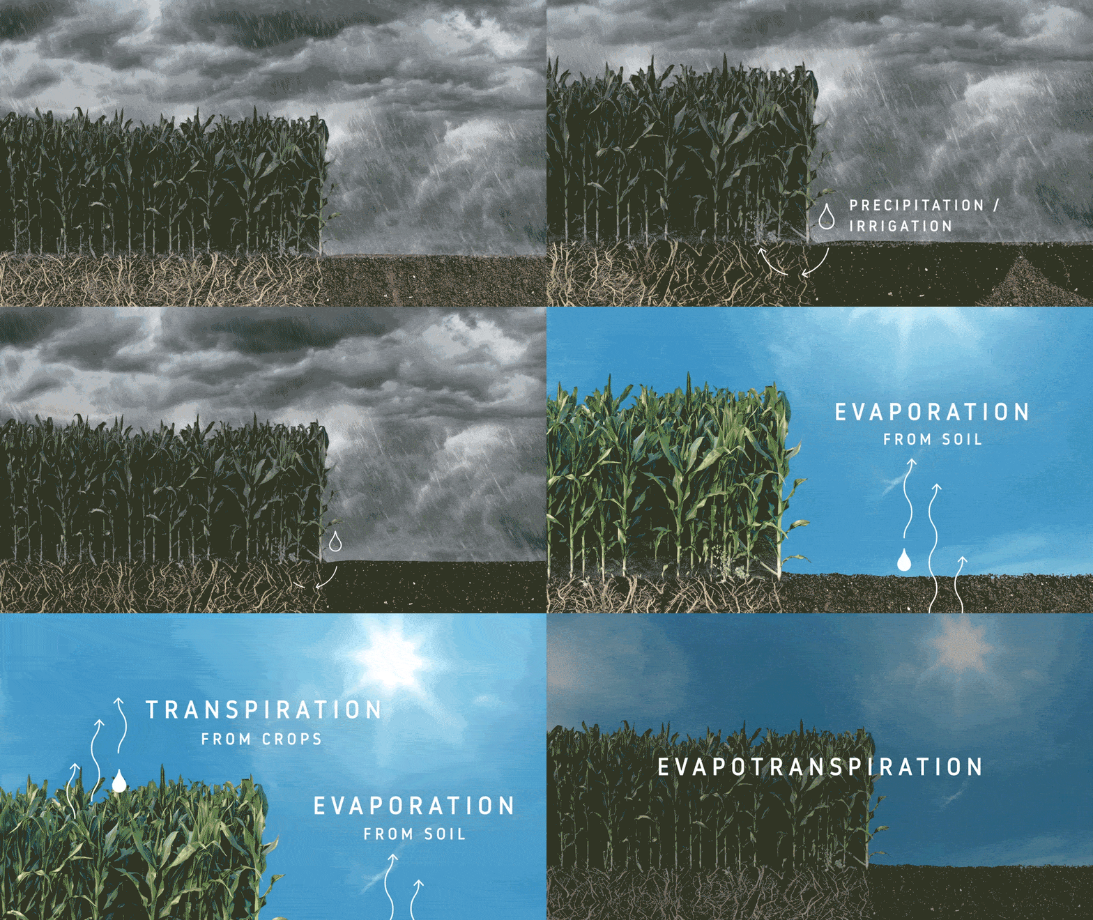
As soil and other surfaces dry, water is transferred into the air as water vapor. That is evaporation. Plants actively release water, moving it out of their leaves and stems and into the drier air. That is transpiration. Combine the…

Article3 years ago

NASA Satellites Help Plan Future for Palau Fish Stocks

8 min read

It’s the weekend, and freshly caught fish sizzles on the grill. The view: an unforgettable beach and the cobalt blues of the Pacific Ocean in the backdrop. This is not paradise. It’s a typical Sunday for many people in Palau,…

Article3 years ago

Seeing the COVID-19 Pandemic from Space

2 min read

Economic and social shutdowns in response to the COVID-19 pandemic have led to noticeable changes in Earth’s environment, at least for the short term. NASA researchers are using satellite and ground-based observations to track these impacts on our air, land,…

Article4 years ago

AGU Panel Explores Environmental Impacts of the COVID-19 Pandemic, as Observed from Space

6 min read

COVID-19 has changed the way we live and work, as various health and safety restrictions keep more of us at home more often. The resulting changes to our behavior are already impacting the environment around us in myriad ways, according…

Article4 years ago

Satellite Data Meets Cellular DNA for Species of Interest

4 min read

The roughly 23-million-acre National Petroleum Reserve in Alaska is rich in oil and gas resources – and rich in native fish populations. NASA scientists are combining data from water samples containing fish DNA with satellite data to find native fish…

Article4 years ago

NASA Population Modeling Makes Humanitarian Efforts More Precise

3 min read

Models based in part on a method NASA has used to track and count wild salmon in Nevada can now be used by governments and humanitarian organizations to more accurately estimate populations and allocate aid to remote regions of the…

Article4 years ago

Transforming Water Management in the U.S. West with NASA Data

5 min read

Building upon more than two decades of research, a new web-based platform called OpenET will soon be putting NASA data in the hands of farmers, water managers and conservation groups to accelerate improvements and innovations in water management. OpenET uses…

Article4 years ago

Pinpointing Tropical Forests with High Ecological ‘Quality’

4 min read

Editor’s note, Jan. 14, 2021: This feature has been corrected to show that the data used came from the ICESat satellite, not ICESat-2 as originally published. High-resolution NASA satellite data have made it possible for scientists to develop maps showing the…

Article4 years ago

NASA Study Maps the Roots of Global Mangrove Loss

6 min read

Using high-resolution data from the joint NASA-U.S. Geological Survey Landsat program, researchers have created the first map of the causes of change in global mangrove habitats between 2000 and 2016 – a valuable tool to aid conservation efforts for these…

Article4 years ago