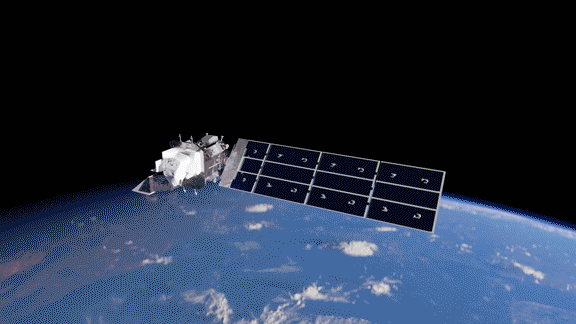


Instruments
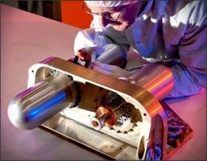
Thermal Infrared Sensor (TIRS)
The Thermal Infrared Sensor (TIRS) measures land surface temperature in two thermal infrared bands using principles of quantum physics to detect heat emitted from the Earth’s surface. TIRS is an invaluable tool for tracking and managing water consumption.
Overview
TIRS is a specialized instrument that uses quantum physics principles to measure land surface temperature. TIRS employs Quantum Well Infrared Photodetectors (QWIPs) to detect long wavelengths of light—thermal infrared energy—well beyond the range of human vision. Researchers at NASA’s Goddard Space Flight Center helped advance QWIPs as a new, lower-cost alternative to conventional infrared technology.
TIRS was added to the Landsat mission to fulfill the critical need for accurate thermal measurements by state water resource managers, particularly in the Western U.S. where nearly 80 percent of fresh water is used for crop irrigation.
Requirements
The TIRS instrument on Landsat 8 was designed with sufficient redundancies to ensure the collection of science-grade data over a three-year design life and to meet stringent technical specifications set out in the Program Level Requirements Appendix (PLRA) document:
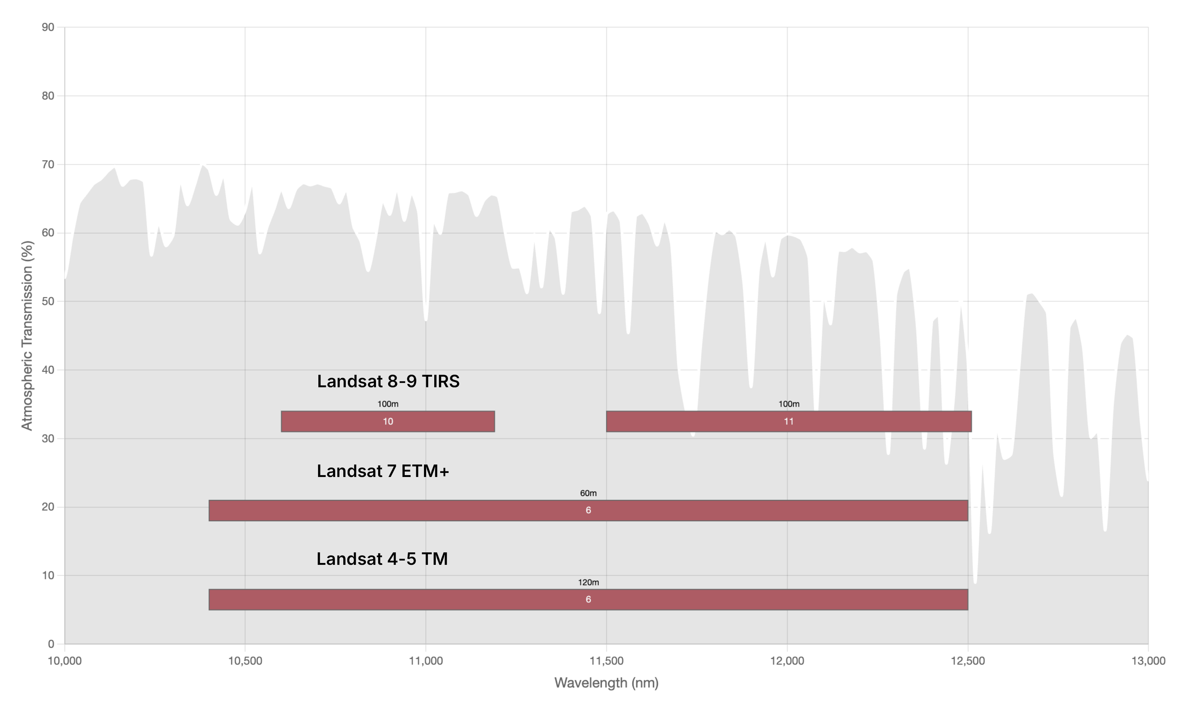
- Spectral and spatial requirements: Collect image data in two thermal-infrared spectral bands with 120-meter (395-foot) spatial resolution across a 185-kilometer (115-mile) swath from an altitude of 705 kilometers (438 miles). The actual instrument design achieves 100-meter (328-foot) resolution.
- Rationale: These two spectral bands are necessary for atmospheric correction. The 120-meter (395-foot) spatial resolution meets user needs for water resource analysis, as it allows for field-scale analysis. Edge slopes consistent with 120-meter GSD.
- Radiometric requirements: Absolute calibration uncertainty of less than 2% for targets between 260-330 K (less than 4% for targets between 240-260 K and 330-360 K).
- Rationale: Absolute calibration is required for measuring surface temperatures.
- Additional requirements: Maintain cross-track spectral uniformity, edge response, image geometry and geolocation, and spectral band co-registration.
Advancements on Landsat 9 TIRS
Landsat 9 TIRS was designed with additional redundancies to meet requirements for a 5-year design life. Landsat 8 TIRS had a notable problem with stray light reaching the focal plane. In February 2017, an algorithm was implemented to correct the thermal data. In Landsat 9, engineers improved optics inside the sensor to correct this issue, creating a more permanent and comprehensive hardware solution.
Science Objectives
- Monitor evapotranspiration and water use on a regional and field-scale in the U.S. and internationally
- Map urban heat fluxes for air quality modeling
- Assess, monitor, and aid response to volcanic hazards
- Improve cloud detection in OLI data
- Map waterway thermal plumes from power plants
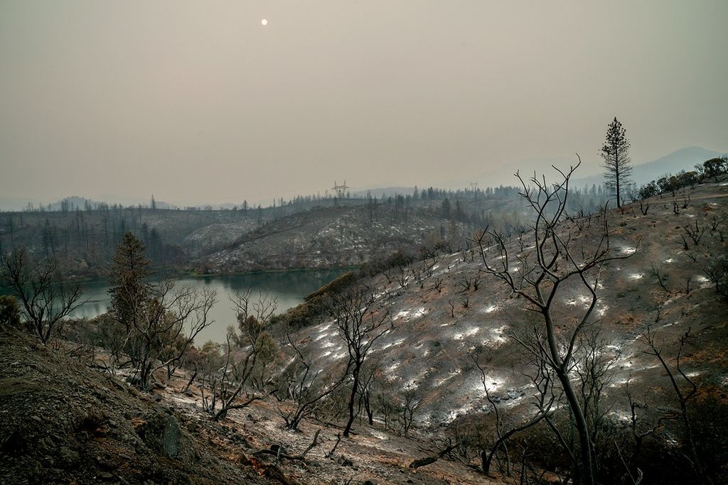
- Map burned area
- Assess wildfire risk
- Identify mosquito breeding areas for analyzing potential spread of vector-borne illness
- Manage forests and other land types
Design
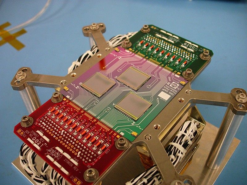
TIRS employs a push-broom sensor architecture featuring a focal plane with three arrays of photosensitive detectors, called quantum well infrared photodetectors (QWIPs). Photons directed to the focal plane first pass through one of two spectral interference filters that transmit only wavelengths between either 10.6 – 11.2 µm or 11.5 – 12.5 µm. The filtered photons then strike the QWIP detector material, generating electrons which are captured in an energy state ‘well’. This process creates an electrical signal. The more thermal energy that hits the QWIP detector material, the stronger the resultant electrical signal.
Before converting this electrical signal to a surface temperature reading, scientists first have to remove the thermal energy emitted by the TIRS instrument itself. They do so by comparing the view of Earth with a view of space—where the temperature is nearly absolute zero—thereby isolating only the true signal coming from Earth. This signal is then converted into at-sensor radiance for every pixel in the image using calibration functions generated during pre-launch instrument testing. These calibration functions are routinely checked by viewing the onboard blackbody source to track any sensitivity changes in the instrument. In the final image, the calibrated pixel values represent Earth temperatures, where brighter pixels represent hotter areas on the Earth’s surface.
The TIRS instrument uses a four-element refractive telescope that focuses an f/1.64 beam of thermal radiation onto a cryogenically cooled focal plane while providing a 15-degree field-of-view matching the 185 km across-track swath. A critical component is the two-stage mechanical cryocooler that maintains the focal plane at the required 43 K operating temperature, with two radiators managing heat dissipation and maintaining constant telescope temperature at 185 K.
Spectral Bands
TIRS collects data in two thermal-infrared spectral bands at 100 m spatial resolution. Bands 10 (10.6-11.2 μm) and 11 (11.5-12.5 μm) allow the sensor to separate Earth's surface temperature from atmospheric temperature effects. Each focal plane module is covered by spectral filters that transmit the two specified bandwidths, enabling the innovative QWIP arrays to detect these narrow segments of the thermal-infrared spectrum. This represents an advancement over previous Landsat sensors that collected data in only one thermal band, providing enhanced accuracy in land surface temperature measurements.
| Band | Band Width (μm) | GSD (m) |
|---|---|---|
| Band 10 - Thermal-infrared (TIR) 1 | 10.6-11.2 | 100 (resampled to 30) |
| Band 11 - Thermal-infrared (TIR) 2 | 11.5-12.5 | 100 (resampled to 30) |
We can look at the types of crops being grown, we can measure their health, we can look at agricultural productivity. We can also use the surface temperature measurements from TIRS, and energy budget models, to measure crop water consumption, which is an important application in the western U.S.

Jeff Masek
Former NASA Landsat 9 Project Scientist
Selected Publications
Gerace, A., Kleynhans, T., Eon, R., & Montanaro, M. (2020). Towards an operational, split window-derived surface temperature product for the Thermal Infrared Sensors onboard Landsat 8 and 9. Remote Sensing, 12(2), 224.
Irons, J. R., Dwyer, J. L., & Barsi, J. A. (2012). The next Landsat satellite: The Landsat Data Continuity Mission. Remote Sensing of Environment, 122, 11–21. https://doi.org/10.1016/j.rse.2011.08.026
Markham, B., Anderson, C., Barsi, J., Choate, M., Donley, E., Efremova, B., Hair, J., Jenstrom, D., Kaita, E., Knight, E., Kvaran, G., Mccorkel, J., Montanaro, M., Morland, E., Pedelty, J., Pearlman, A., Sauer, B., Storey, J., & Wenny, B. (2019). Landsat 9: Mission status and prelaunch instrument performance characterization and calibration. https://ntrs.nasa.gov/api/citations/20200000060/downloads/20200000060.pdf
Masek, J. G., Wulder, M. A., Markham, B., McCorkel, J., Crawford, C. J., & Jenstrom, D. T. (2020). Landsat 9: Empowering open science and applications through continuity. Remote Sensing of Environment, 248(111968). https://doi.org/10.1016/j.rse.2020.111968
Montanaro, M., McCorkel, J., Tveekrem, J., Stauder, J., Mentzell, E., Lunsford, A., Hair, J., & Reuter, D. (2022). Landsat 9 Thermal Infrared Sensor 2 (TIRS-2) stray light mitigation and assessment. IEEE Transactions on Geoscience and Remote Sensing, 60, 1–8. https://doi.org/10.1109/tgrs.2022.3177312
Reuter, D., Richardson, C., Pellerano, F., Irons, J., Allen, R., Anderson, M., Jhabvala, M., Lunsford, A., Montanaro, M., Smith, R., Tesfaye, Z., & Thome, K. (2015). The Thermal Infrared Sensor (TIRS) on Landsat 8: Design overview and pre-launch characterization. Remote Sensing, 7(1), 1135–1153. https://doi.org/10.3390/rs70101135
Wulder, M. A., White, J. C., Goward, S. N., Masek, J. G., Irons, J. R., Herold, M., Cohen, W. B., Loveland, T. R., & Woodcock, C. E. (2008). Landsat continuity: Issues and opportunities for land cover monitoring. Remote Sensing of Environment, 112(3), 955–969. https://doi.org/10.1016/j.rse.2007.07.004