


QuikSCAT Stories
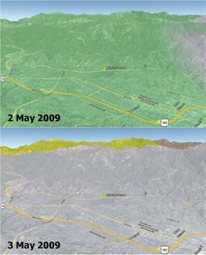
Disaster Management: Rapid Dry-Up of Rainwater on Land Surface Leading to the Santa Barbara Wildfire
3 min read
In Santa Barbara County, a wildfire, called the Jesusita fire, ignited on May 5, 2009 in the Cathedral Peak area northwest of Mission Canyon. Data is from NASA's QuikScat satellite.
Article
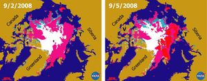
Recent State of Arctic Sea Ice
3 min read
This pair of sea ice maps was derived from radar data from NASA's QuikScat satellite scatterometer during September, 2008 showing the Arctic Sea along the Northern Sea Route and the Northwest Passage.
Article
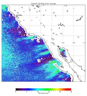
NASA’s QuikScat Maps Southern California’s Destructive Santa Ana Winds
1 min read
The scope and extent of the strong Santa Ana wind event in Southern California the week of Oct. 21, 2007, is visible in this image from NASA's QuikScat satellite.
Article