


Science + Spacecraft
Sentinel-6B Science
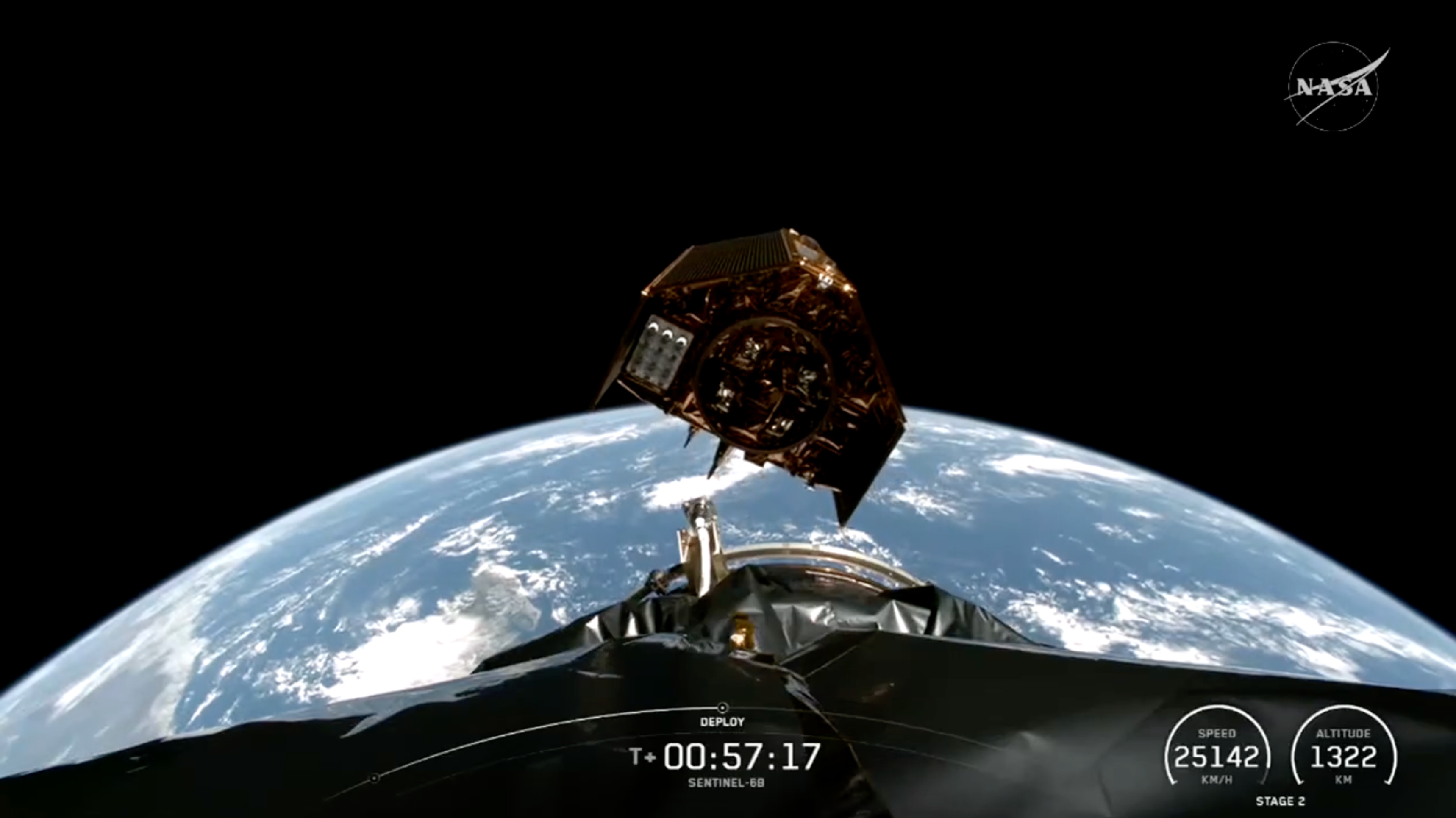
Sentinel-6B is the latest satellite in a series of spacecraft that NASA and its partners have used to measure sea levels since 1992. Their data has helped meteorologists improve hurricane forecasts, managers protect infrastructure, and coastal communities plan.
Data from Sentinel-6B will continue a decades-long record of sea surface height, helping to improve coastal planning, protect critical infrastructure, and advance weather forecasts.
After launch, Sentinel-6B will begin the process of data cross-calibration with its predecessor, Sentinel-6 Michael Freilich, to provide essential information about Earth’s ocean.
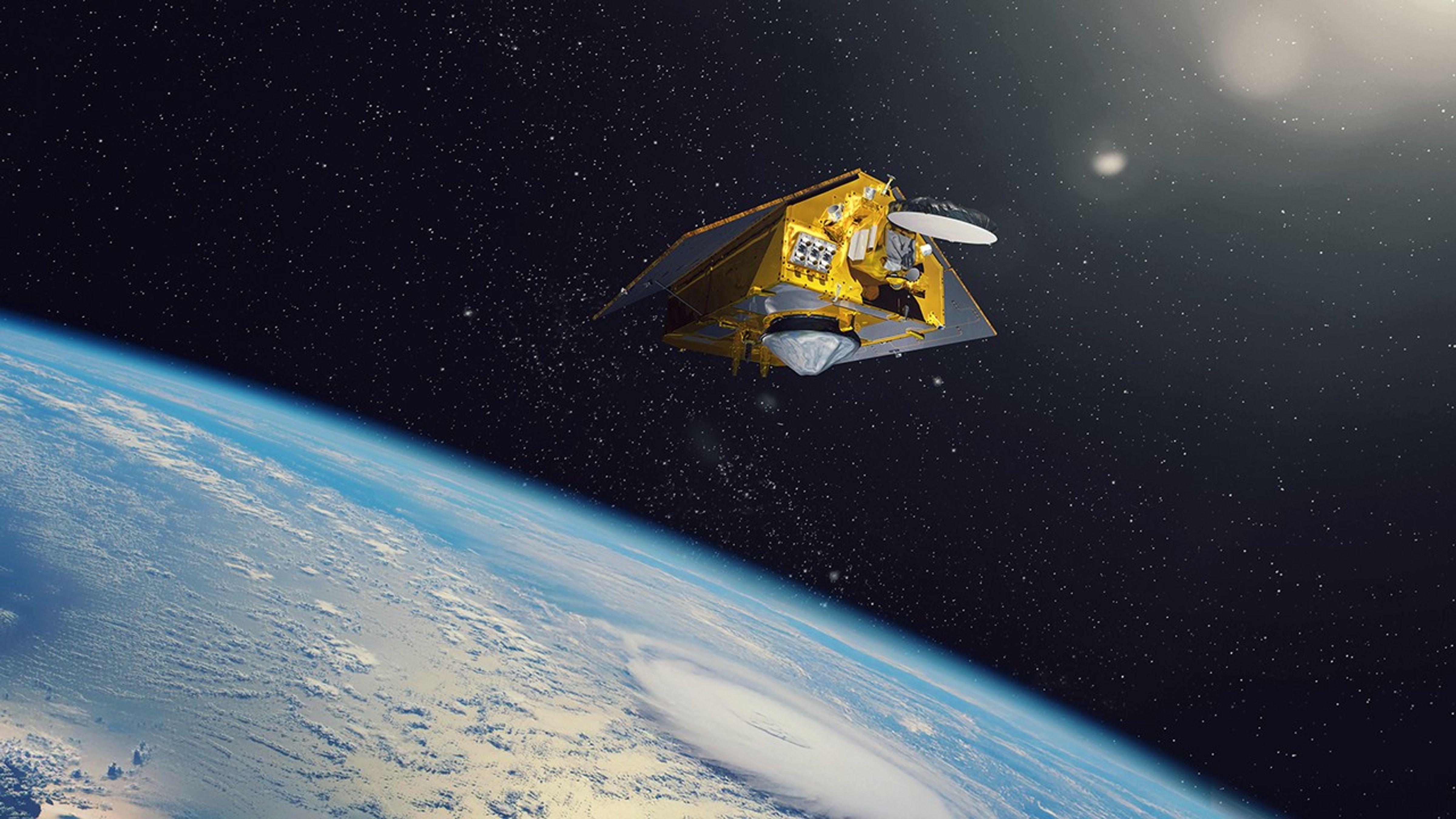
The twin satellites, Sentinel-6B and Sentinel-6 Michael Freilich, constitute the Sentinel-6/Jason-CS (Continuity of Service) mission, a collaboration between NASA, ESA (European Space Agency), EUMETSAT (European Organisation for the Exploitation of Meteorological Satellites), and the National Oceanic and Atmospheric Administration (NOAA). The European Commission contributed funding support while France’s space agency CNES (Centre National d’Études Spatiales) provided technical expertise.
Learn More
Spacecraft
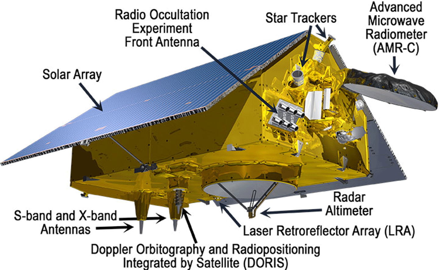
The Sentinel-6B spacecraft consists of a main satellite bus, which holds three science instruments contributed by NASA’s Jet Propulsion Laboratory in Southern California. As part of this U.S.-European mission, NASA is also contributing launch services, ground systems supporting operation of the NASA science instruments, the science data processors for two of these instruments, and support for the international ocean surface topography community.
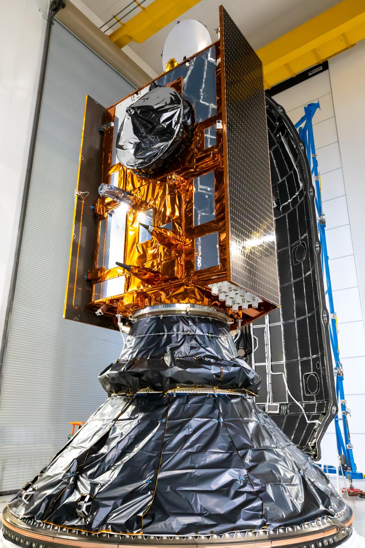
Satellite bus: The Sentinel-6B spacecraft was built by Airbus Defence and Space in
Friedrichshafen, Germany. It is 19.1 feet (5.82 meters) long (including the AMR-C instrument), 7.74 feet (2.36 meters) high (including the communications antennas), and 14.28 feet (4.33 meters) wide (with solar panels deployed).
Mass: 2,623 pounds (1,190 kilograms), including onboard propellant at launch.
Power: Two fixed solar arrays, plus two deployable solar panels.
Batteries: 200-amp-hour battery consisting of 1,152 lithium-ion cells.
Instruments: Poseidon-4 synthetic aperture radar (SAR) Altimeter, Advanced Microwave Radiometer for Climate (AMR-C), Global Navigation Satellite System - Radio Occultation (GNSS-RO), and Precise Orbit Determination (POD) Package (POD).
Instruments
Poseidon-4 SAR Altimeter
The scientific heart of the mission, the Poseidon-4 synthetic aperture radar (SAR) altimeter measures the height of seawater by bouncing radar pulses off of Earth’s ocean and precisely timing how long those pulses take to travel back to the spacecraft. The instrument is also used to determine significant wave height and wind speed.
Advanced Microwave Radiometer for Climate (AMR-C)
Water vapor affects the radar signals from the altimeter instrument, which can make the height of the water it’s measuring appear higher or lower than it actually is. The radiometer measurements of water vapor between the satellite and Earth’s surface are required to correct for this effect.
Global Navigation Satellite System - Radio Occultation (GNSS-RO)
This instrument measures the physical properties of Earth’s atmosphere, including temperature, pressure, and water vapor content. It does so by detecting the extent to which the planet’s atmosphere refracts the radio signals from global navigation satellites as the spacecraft disappear beyond the limb of Earth.
Precise Orbit Determination (POD) Package
Precisely determining the position of the Sentinel-6B spacecraft in orbit is of paramount importance when recording extremely small variations in sea level data (on the millimeter scale). To achieve this, Sentinel-6B carries a state-of-the-art precise orbit determination package that works in conjunction with the mission’s science instruments to accurately define its position in space and time.
The four instruments composing this package include the Doppler orbitography and Radiopositioning Integrated by Satellite (DORIS), the laser retroreflector array (LRA), the GNSS-RO, and the Global Navigation Satellite System - Precise Orbit Determination (GNSS-POD).
6 Things to Know From NASA About New US, European Sea Satellite
Data from Sentinel-6B will continue a decades-long record of sea surface height, helping to improve coastal planning, protect critical infrastructure,…
Read the Story
Learn More About Sentinel-6B and Its Predecessors
Visit the Jason-CS/Sentinel-6 program website and learn more about Sentinel-6B and its twin predecessor, Sentinel-6 Michael Freilich, which launched in November 2020 and was named in honor of the late director of NASA’s Earth Science Division.
Visit the program website for Jason-CS/Sentinel-6 — ‘Ocean Surface Topography from Space’


