![Request for Information – Potential [Placeholder for Prize]](https://assets.science.nasa.gov/dynamicimage/assets/science/psd/solar/2023/09/s/solarsystem_0.jpg?w=1024)


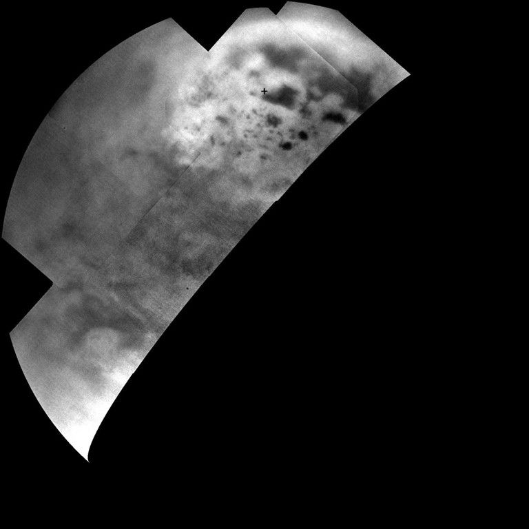
Ultracold hydrocarbon lakes and seas (dark shapes) near the north pole of Saturn's moon Titan can be seen embedded in some kind of bright surface material in this infrared mosaic from NASA's Cassini mission.
T-109: Mapping Titan’s North Pole in Infrared
During this close flyby of Titan, the Cassini visible and infrared mapping spectrometer (VIMS) used its “push broom” mode to take a high-resolution swath across Titan's North Pole region. This path crossed Punga Mare and (depending on the encounter geometry) Kivu Lacus, looking for composition differences in bright spots, called faculae, and the dunes. VIMS first looked for specular reflection on the northeastern tip of Kraken Mare and across the strait that links Kraken and Ligeia and then acquired a few high-resolution images of the lakes. The instrument also imaged the southern hemisphere to view the evolution of Titan's south polar vortex.
Titan Flyby at a Glance
Date
Feb. 12, 2015
Altitude
745 miles (1,200 km)
Speed
12,974 mph (5.8 km/sec)