By Amit Angal, Senior Engineer at Goddard Space Flight Center
The Landsat Calibration and Validation (Cal/Val) group helps uphold Landsat's reputation as the gold standard of satellite imagery. They ensure that the Operational Land Imager (OLI) and the Thermal Infrared Sensor (TIRS) aboard Landsats 8 and 9 provide high-quality scientific measurements to users around the world. In 2025, the Cal/Val group contributed over 60 pages to the second edition of “Comprehensive Remote Sensing” (Kaita et. al, 2026), organizing content from NASA, USGS, academia, and industry scientists. Cal/Val support staff authored multiple sections, including a summary of results from Landsat 9 and of the evolution of spectral, spatial, and radiometric characteristics throughout the Landsat missions.
The Cal/Val team at NASA Goddard Space Flight Center works closely with the USGS Landsat Flight Operations Team to plan weekly calibration activities to maintain the radiometric accuracy of Landsat products. In October 2025, a Landsat 9 anomaly occurred related to its solar array drive assembly (SADA) potentiometer. The spacecraft and instruments were placed in a safehold, pausing data collections. The Cal/Val team assessed the instruments after they recovered from this anomaly, including monitoring the instrument telemetry, detector gains, and noise performance. The team identified a mis-loaded detector map and updated the calibration of both the reflective and thermal emissive bands to ensure consistent, accurate data. After six days in the safehold, the instrument resumed normal operations.
The NASA Cal/Val team supports their USGS counterparts with quarterly updates to the Calibration Parameter File (CPF) by providing inputs for relative and absolute gains as needed. This work involves collaborating with USGS scientists to ensure the consistency of the Combined Radiometric Model (CRaM). The CRaM approach integrates radiometric responses from on-board calibrators to enhance long-term calibration stability throughout mission lifetimes. The CRaM algorithm also provides an extensible framework for future satellite missions. A peer-reviewed publication detailing the CRaM’s approach and future applications was submitted to Science of Remote Sensing.
On January 14-16, 2025, the Landsat Cal/Val team organized and hosted the first semiannual Technical Information Meeting (TIM) at NASA Goddard Space Flight Center. NASA and USGS scientists welcomed collaborating scientists from South Dakota State University (SDSU), the University of Arizona Tucson, and Rochester Institute of Technology for presentations and discussions on Landsat imaging performance, algorithms, and instrument health. On May 28-29, 2025, the Cal/Val team attended the second semiannual TIM at SDSU.
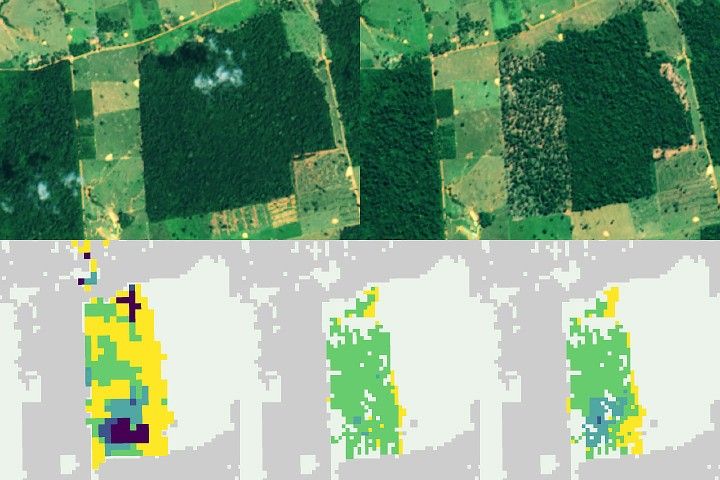
The Landsat Cal/Val Team is validating the accuracy of the Harmonized Landsat and Sentinel-2 (HLS) v2.0 product, which combines data from multiple satellites to create a continuous record of Earth's surface reflectance measurements since 2013. The team is testing the dataset using RadCalNet, a global network of automated ground stations that provide precise, standardized measurements. The team compared measurements from four RadCalNet sites, including the well-established Railroad Valley Playa site in Nevada, against near-simultaneous HLS data. Their analysis shows the satellite and ground measurements agree within expected uncertainty ranges—a strong validation of the HLS product's accuracy.
The team presented these findings at the CEOS IVOS calibration meeting in Tucson, Arizona (September 1-5, 2025) and is currently preparing a peer-reviewed article to share the complete results.
Path Forward
The Cal/Val team applies lessons learned from Landsat missions to better plan calibration efforts for the next generation of instruments. Using instrument performance checklists from Landsat 8/9, the team is building a framework of in-house geometric and radiometric testing and extending algorithms for future Landsat instruments.
The Landsat Cal/Val Team is actively tackling a critical challenge in solar irradiance modeling. While new hyperspectral sensor technologies have made it possible to create highly accurate solar models with much lower uncertainty, the remote sensing community still lacks agreed-upon methods for applying these advanced models. A dedicated subgroup within the Landsat Cal/Val Team is now developing and testing standardized approaches to bridge this gap. Their goal is to create clear recommendations and best practices that the scientific community can refine together and implement consistently.
This work addresses a fundamental need—transforming promising hyperspectral solar modeling capabilities into practical, standardized tools that researchers can confidently use across different projects and applications.