Description
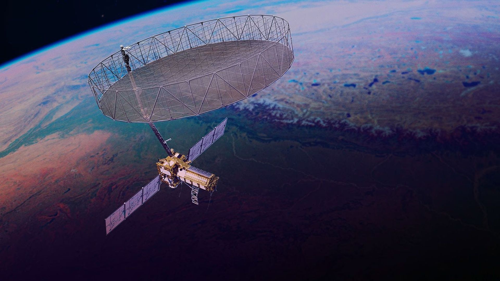
This artist's concept depicts the NISAR satellite orbiting Earth. Short for NASA-ISRO Synthetic Aperture Radar, the mission is an equal collaboration between NASA and the Indian Space Research Organisation and marks the first time the two agencies have cooperated on hardware development for an Earth-observing mission.
Observations from NISAR will benefit humanity by helping researchers around the world better understand changes in our planet's surface, including its ice sheets, glaciers, and sea ice. It also will capture changes in forest and wetland ecosystems and track movement and deformation of our planet's crust by phenomena such as earthquakes, landslides, and volcanic activity. The global and rapid coverage from NISAR will provide unprecedented support for disaster response, producing data to assist in mitigating and assessing damage, with observations before and after catastrophic events available in short time frames.
NISAR launched from ISRO's Satish Dhawan Space Centre on India's southeastern coast on July 30, 2025.
Find more information about NISAR here:


