


Description
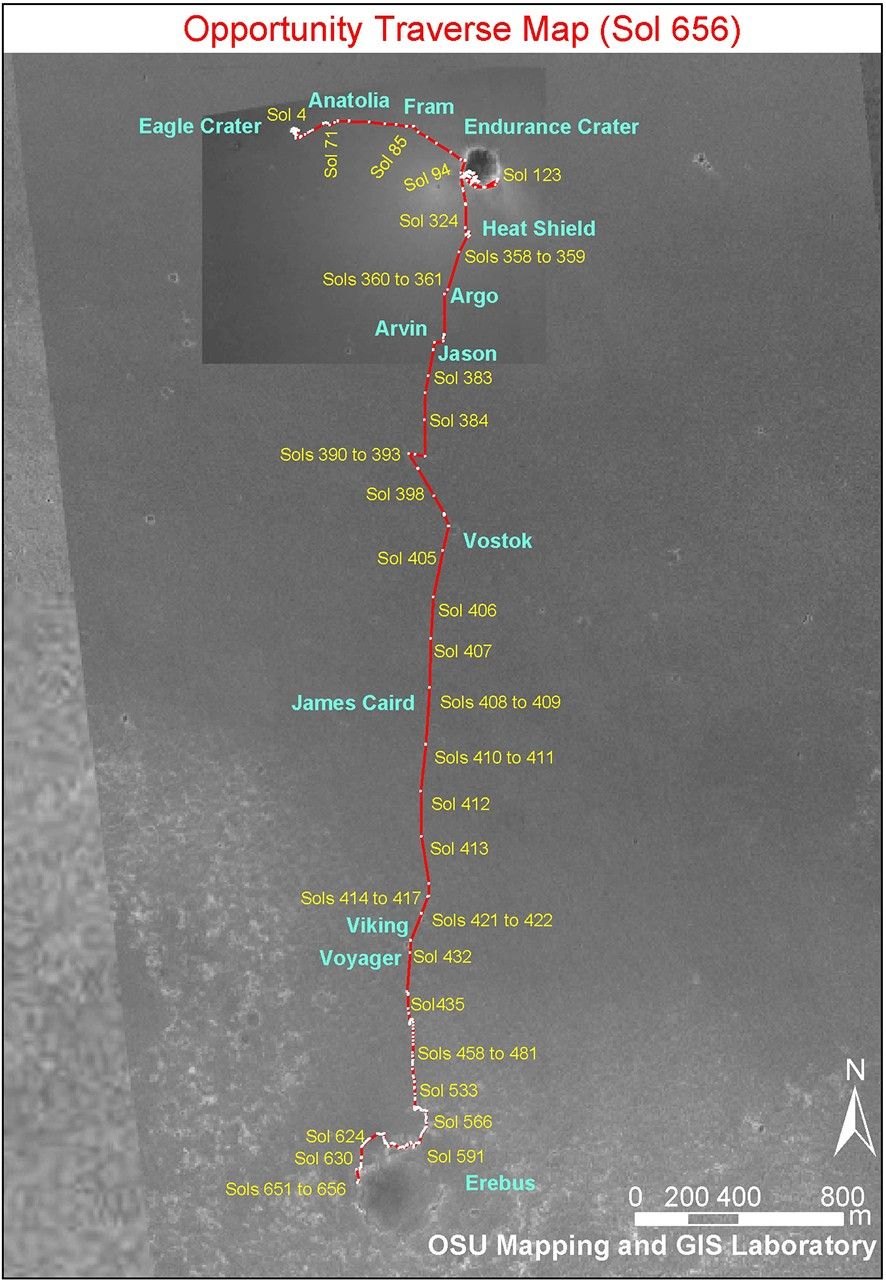
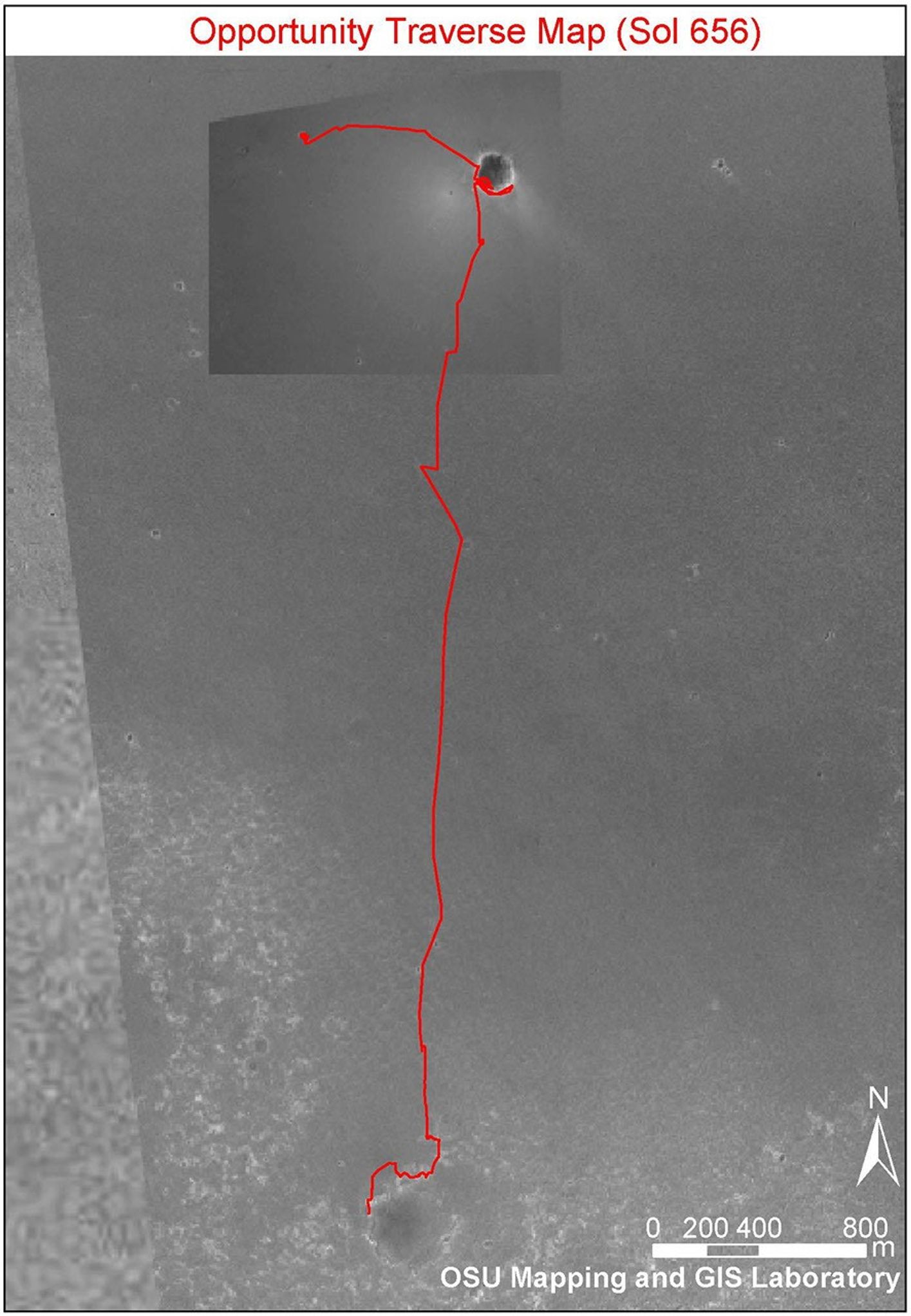
Annotated Opportunity Traverse Map
This image shows the route that NASA's Mars Exploration Rover Opportunity has taken from its landing site inside "Eagle Crater" to its position on its 656th Martian day, or sol, (Nov. 27, 2005) at the edge of "Erebus Crater." The base image is a portion of a mosaic (previously released as PIA07506) combining images from the Mars Observer Camera on NASA's Mars Global Surveyor orbiter, the Thermal Emission Imaging System on NASA's Mars Odyssey orbiter, and Opportunity's own Descent Image Motion Estimation System. The scale bar at lower right is 800 meters (one-half mile). As of sol 656, Opportunity had driven a total of 6,502 meters (4.04 miles).


