


Description
Context image
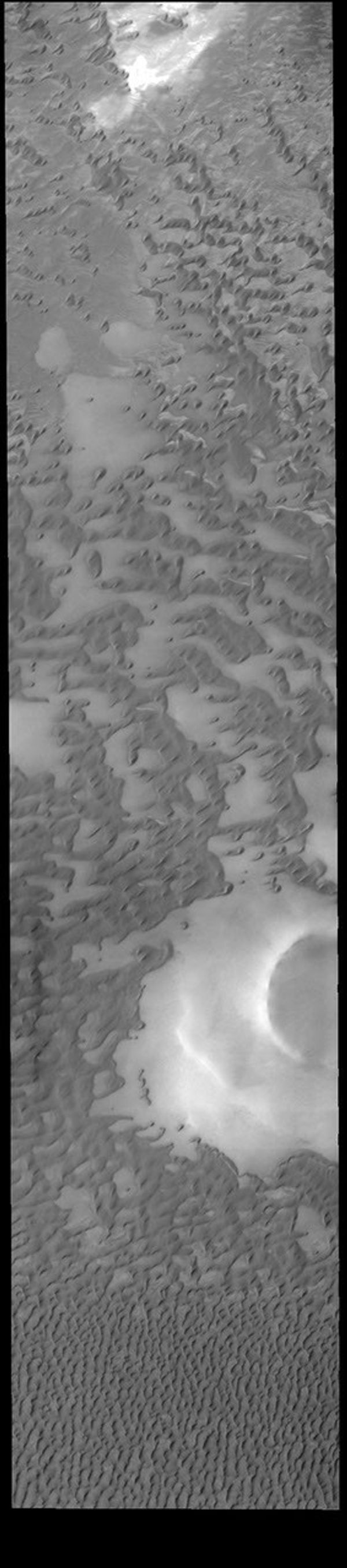
This VIS image shows part of Olympia Undae, a large dune field that surrounds part of the north polar cap. At the top of the image the dunes are small and isolated. As the amount of available sand increases the density of dunes increases. This is seen at the bottom of the image. Collected during northern summer, the dunes are completely free of ice and frost.
Orbit Number: 71822 Latitude: 79.9343 Longitude: 143.91 Instrument: VIS Captured: 2018-02-22 00:15
Please see the THEMIS Data Citation Note for details on crediting THEMIS images.
NASA's Jet Propulsion Laboratory manages the 2001 Mars Odyssey mission for NASA's Science Mission Directorate, Washington, D.C. The Thermal Emission Imaging System (THEMIS) was developed by Arizona State University, Tempe, in collaboration with Raytheon Santa Barbara Remote Sensing. The THEMIS investigation is led by Dr. Philip Christensen at Arizona State University. Lockheed Martin Astronautics, Denver, is the prime contractor for the Odyssey project, and developed and built the orbiter. Mission operations are conducted jointly from Lockheed Martin and from JPL, a division of the California Institute of Technology in Pasadena.


