


Description
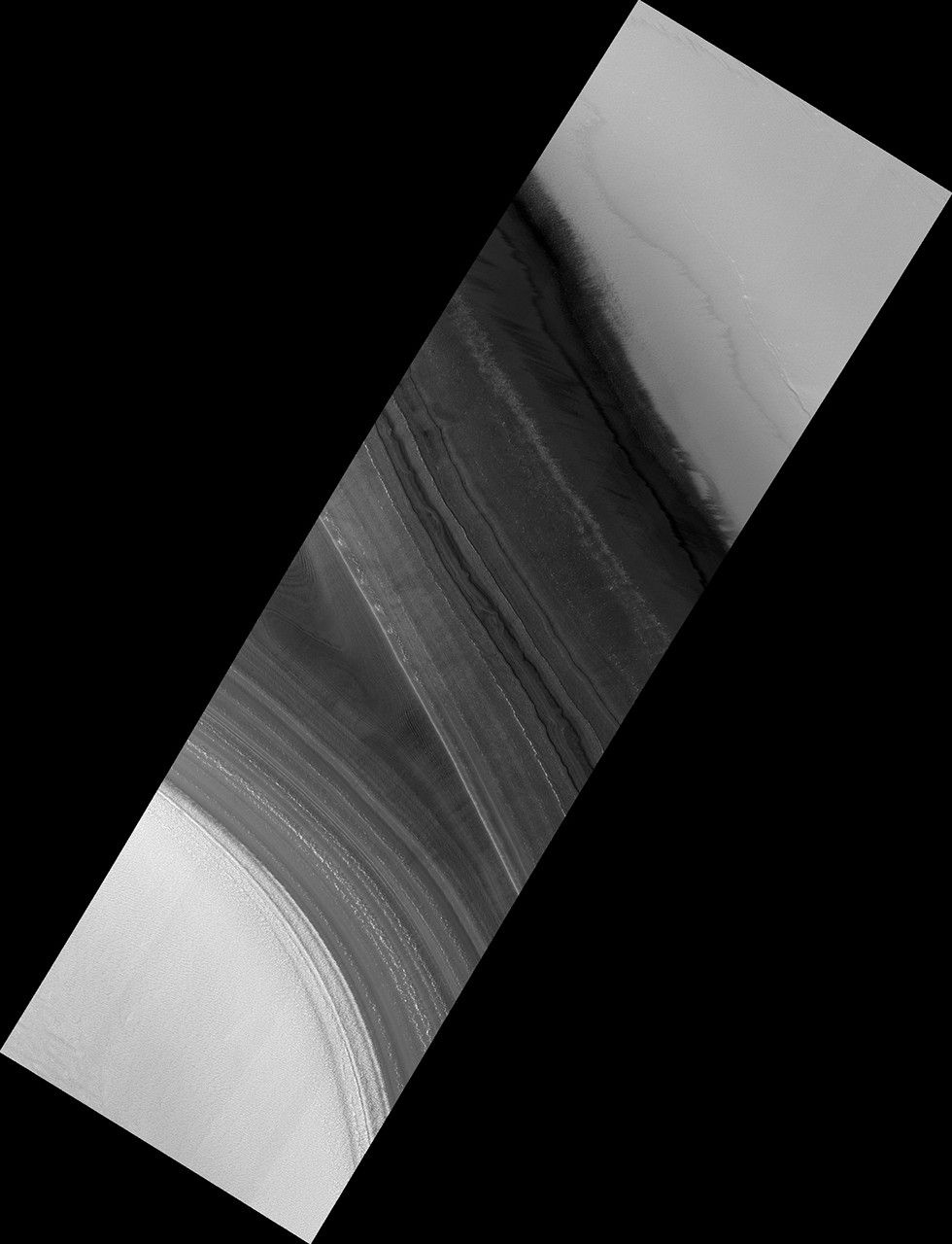
Map Projected Browse Image
Click on the image for larger version
This 2008 image shows a portion of the North Polar layered deposits with lines of very small pits, only about 1 meter in diameter.
Such small pits should be quickly filled in by seasonal ice and dust, so their existence suggests active processes such as faults pulling apart the icy layers.
This is a stereo pair with PSP_009873_2645.
The map is projected here at a scale of 25 centimeters (9.8 inches) per pixel. [The original image scale is 33.3 centimeters (13.1 inches) per pixel (with 1 x 1 binning); objects on the order of 100 centimeters (39.3 inches) across are resolved.] North is up.
The University of Arizona, Tucson, operates HiRISE, which was built by Ball Aerospace & Technologies Corp., Boulder, Colo. NASA's Jet Propulsion Laboratory, a division of Caltech in Pasadena, California, manages the Mars Reconnaissance Orbiter Project for NASA's Science Mission Directorate, Washington.


