


Description
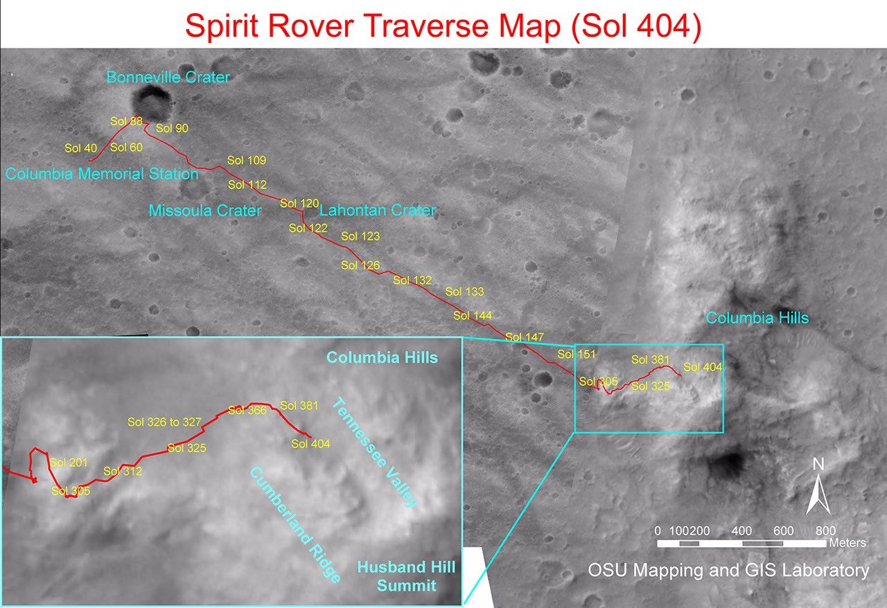
Figure 1
NASA's Mars Exploration Rover Spirit drove a total of 4,143 meters (2.57 miles) between its landing in January 2004 and its 404th martian day, or sol (Feb. 20, 2005). This map on an image taken by the Mars Orbiter Camera on NASA's Mars Global Surveyor shows the course the rover drove during that time. The rover has recently been approaching a ridge overlooking "Tennessee Valley" on the north flank of "Husband Hill."


