


Description
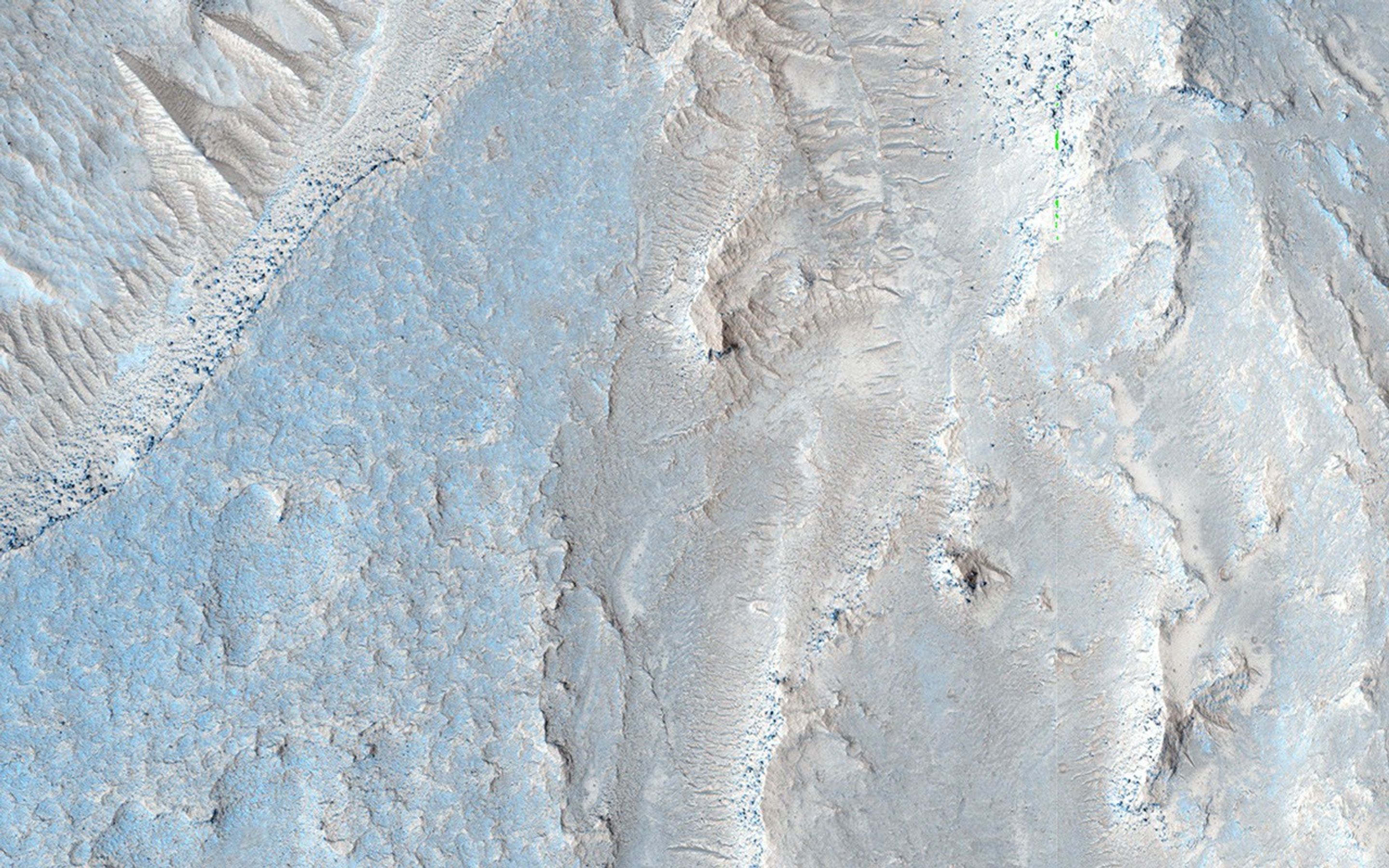
Map Projected Browse Image
Click on the image for larger version
This observation shows the full-width of a HiRISE image and its enhanced color strip, which only covers approximately 20 percent of the picture.
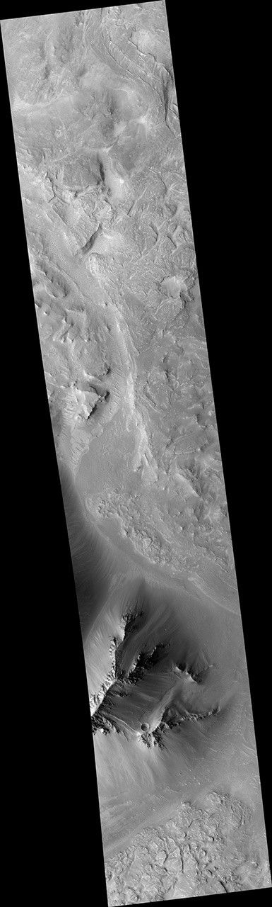
The image is approximately 6 by 6 kilometers and is located east of Noctis Labyrinthus, in a portion the large canyon system Valles Marineris. Visible in this image is a close-up of extensive deposits (some of which has a bluish color) that originated outside of the valley. These deposits appear to have flowed down towards low-lying areas and then bank up against higher topographic features.
Scientists are trying to determine if these deposits represent materials deposited by a massive landslide, an impact crater or a nearby volcanic event.
HiRISE is one of six instruments on NASA's Mars Reconnaissance Orbiter. The University of Arizona, Tucson, operates HiRISE, which was built by Ball Aerospace & Technologies Corp., Boulder, Colorado. NASA's Jet Propulsion Laboratory, a division of the California Institute of Technology in Pasadena, manages the Mars Reconnaissance Orbiter Project for NASA's Science Mission Directorate, Washington.


