


Description

Map Projected Browse Image
Click on image for larger version
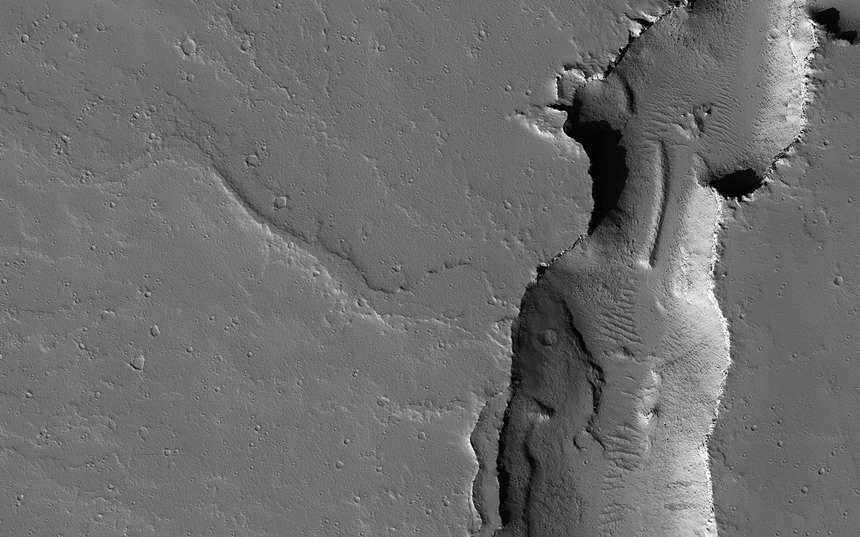
This image shows two cross-cutting depressions that may have been formed by the collapse of weak terrain along pre-existing faults. These faults are associated with the release of volcanic material and/or liquid water.
Sinuous channels are visible emanating from the large vent toward the northwest. Some of these channels transition between positive-relief and negative-relief, suggesting they were once filled with erosion-resistant material. Liquid water is known to produce similar features on Earth.
The map is projected here at a scale of 50 centimeters (19.7 inches) per pixel. (The original image scale is 55.6 centimeters [21.9 inches] per pixel [with 2 x 2 binning]; objects on the order of 167 centimeters [65.7 inches] across are resolved.) North is up.
This is a stereo pair with ESP_075923_2040.
The University of Arizona, in Tucson, operates HiRISE, which was built by Ball Aerospace & Technologies Corp., in Boulder, Colorado. NASA's Jet Propulsion Laboratory, a division of Caltech in Pasadena, California, manages the Mars Reconnaissance Orbiter Project for NASA's Science Mission Directorate, Washington.


