


Description
Map Projected Browse Image
Click on image for larger version
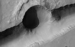
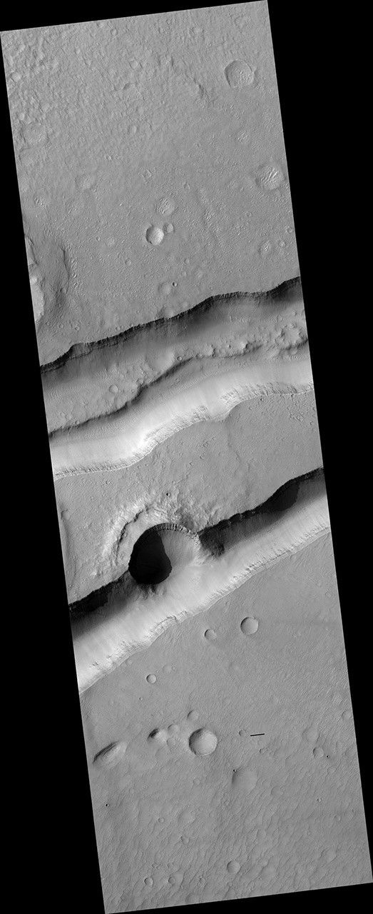
Studying what happened when tells geologists about the history of Mars. A crater that punched through the surface of Mars reveals multiple layers formed previously below the surface. Half of the crater was then destroyed by the opening of the channel.
Small craters pepper the ejecta blanket of the larger crater but a few are visible in the channel, another clue to its younger age. The most recent signs of activity are the boulders that have tumbled down the sides of the channel.
The map is projected here at a scale of 50 centimeters (19.7 inches) per pixel. (The original image scale is 51.2 centimeters [20.2 inches] per pixel [with 2 x 2 binning]; objects on the order of 154 centimeters [60.6 inches] across are resolved.) North is up.
The University of Arizona, in Tucson, operates HiRISE, which was built by Ball Aerospace & Technologies Corp., in Boulder, Colorado. NASA's Jet Propulsion Laboratory, a division of Caltech in Pasadena, California, manages the Mars Reconnaissance Orbiter Project for NASA's Science Mission Directorate, Washington.


