Landsat 9
Filters

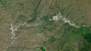
Satellite data show decades of gradual but persistent change to forests around one of the Democratic Republic of the Congo’s…

The USGS Earth Resources Observation and Science Center archive has more than one million Landsat 9 Level-1 products (that’s over…
Between October 2023 and October 2024, the four dams of the Klamath Hydroelectric Project were taken down, opening more than…
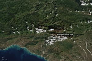
Haiti lost nearly half of its primary forests between 1996 and 2022, with fires and tree-cutting being major drivers of…
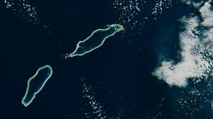
Monitoring the temperature of tiny atoll lagoons is important for the local economy and ecosystem. A new study shows that…

The Amazon is in trouble. Researchers found that, between 2000 and 2022, the Brazilian Amazon lost about 10% of its…

Decades of satellite data paint a picture of how forests in this Central American country are changing.

The largest tropical rainforest in Mesoamerica is shrinking as pastures and croplands spread across Guatemala, Belize, and Mexico. Â

A moisture measurement tool known as OpenET is improving the way farmers, ranchers, and water resource managers steward one of…