Agriculture
Filters

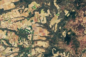
The Landsat satellite program, with its unparalleled 53-year historic record, can reveal changes through the Annual National Land Cover Database…
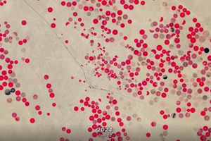
In this animation of 2024 and January 2025, crop fields in Saudi Arabia cycle through their growing seasons.

Using Landsat’s thermal imagery, researchers at Gallo Winery have been able to better understand vineyard water needs and optimize irrigation.
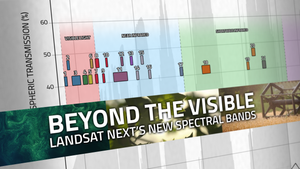
With Landsat Next’s 26 new spectral bands, we’ll be able to see our planet like never before. Landsat Next’s enhanced…

A NASA and U.S. Geological Survey (USGS)-supported research and development team, OpenET, is making it easier for farmers and ranchers…
Using NASA data, researchers can track vegetation changes around the planet, not just in forests but also in grasslands and…

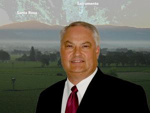
From his South Dakota roots to leading NASA’s agricultural program, Brad Doorn’s mission has remained the same: help farmers feed…
With Landsat-based ET embedded in more and more water rights and conservation tools, Willardson and the Western States Water Council…

A new report about the Landsat satellite program – a partnership between the U.S. Geological Survey and National Aeronautics and…