Disasters
Filters
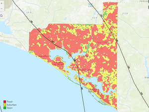
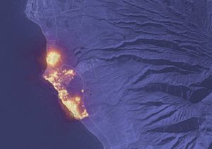
Landsat-based National Land Cover Database (NLCD) helps predict hurricane wind risk to homes and other structures.
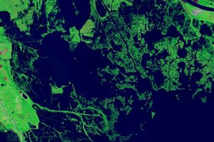
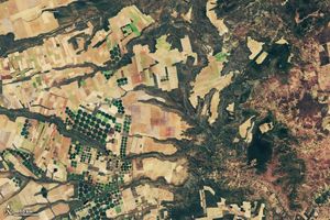
Landsat images show that in the past 40 years alone, Louisiana’s coastal wetlands have undergone substantial changes.
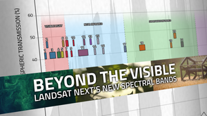
With Landsat Next’s 26 new spectral bands, we’ll be able to see our planet like never before. Landsat Next’s enhanced…
Using NASA data, researchers can track vegetation changes around the planet, not just in forests but also in grasslands and…

Landsat collects data that helps effectively deal with intensifying wildfires—at all stages of the fire cycle.

A new report about the Landsat satellite program – a partnership between the U.S. Geological Survey and National Aeronautics and…

In Taiwan, earthquakes are linked to shallow stores of magma. New research explores this connection by linking land surface temperature…
In the FY23 Aeronautics and Space Report released on May 23, 2024, a multitude of Federal agencies report work informed…

NASA’s Harmonized Landsat and Sentinel-2 (HLS) project is a groundbreaking initiative that combines data from Landsats 8 & 9 with…