Ecosystems and Biodiversity
Filters

The Landsat satellite program, with its unparalleled 53-year historic record, can reveal changes through the Annual National Land Cover Database…
When the first Landsat satellite launched in 1972, it posed the following question: could we manage our natural resources using…
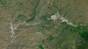
Between October 2023 and October 2024, the four dams of the Klamath Hydroelectric Project were taken down, opening more than…
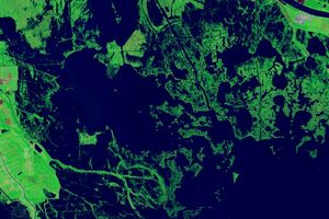
Landsat images show that in the past 40 years alone, Louisiana’s coastal wetlands have undergone substantial changes.
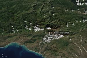
Haiti lost nearly half of its primary forests between 1996 and 2022, with fires and tree-cutting being major drivers of…

Rising sea levels and increased ocean temperatures are supercharging hurricanes. Using satellite data can help monitor vulnerable ecosystems.
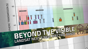
With Landsat Next’s 26 new spectral bands, we’ll be able to see our planet like never before. Landsat Next’s enhanced…

New research led by Landsat 8/9 Project Scientist Chris Neigh used Landsat and ICESat-2 data to investigate how boreal forests…

Grasslands tend to get left out of conservation discussion. New research from the World Resources Institute maps how they’ve changed…