


SAR (Synthetic Aperture Radar)
Filters
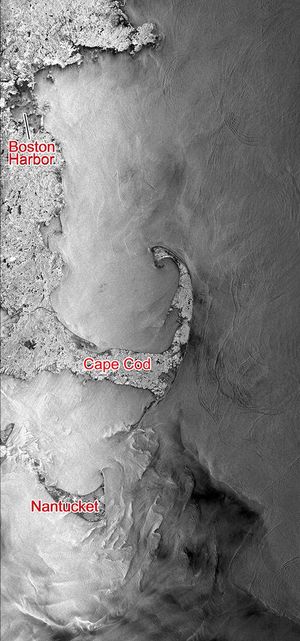
This Seasat synthetic aperture radar image from Aug. 27, 1978, shows the Massachusetts coast from Nantucket Island in the south…
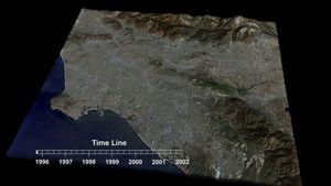
This frame from an animation depicts variations in surface elevation resulting from the discharge and recharge of groundwater basins in…
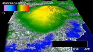
This frame from an animation depicts a time-series of ground deformation at Mount Etna Volcano between 1992 and 2001. The…
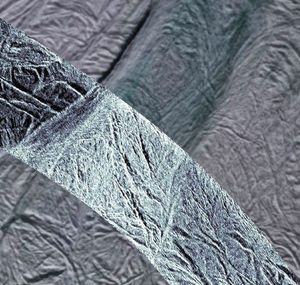
NASA's Cassini spacecraft obtained this view of the south polar area of Saturn's moon Enceladus in visible and near-visible (ultraviolet…
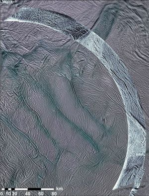
This image using synthetic-aperture radar (SAR) data acquired by NASA's Cassini spacecraft shows grooves in the southern part of Saturn's…
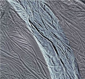
This image shows rough ice in the southern part of Saturn's moon Enceladus. It was created using synthetic-aperture radar (SAR)…
A magnitude 6.6 earthquake struck a sparsely inhabited area of southeast Iran on March 14, 1998, at 11:10 p.m. local…