Landsat
Filters
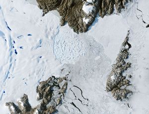
Zachariae Isstrom, a glacier in northeast Greenland, retreated significantly between 1999 and 2022. A recent study found that it lost…
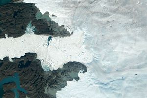
Jakobshavn Isbrae, a glacier on Greenland's western coast, retreated significantly between 1985 and 2022, losing about 97 billion tons (88…
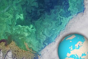
NASA's Landsat 8 satellite collected this view of phytoplankton blooming in the southern Gulf of Bothnia, in the Baltic Sea,…
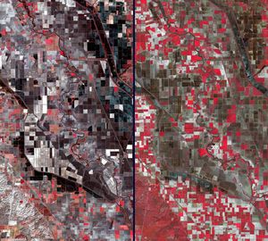
Stark effects of a California drought on agriculture can be clearly seen in these two February images acquired in 2014…
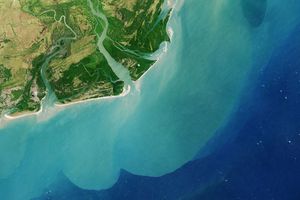
This image acquired by NASA's Landsat 8 satellite shows the Zambezi (also Zambeze), the fourth largest river in Africa, and…
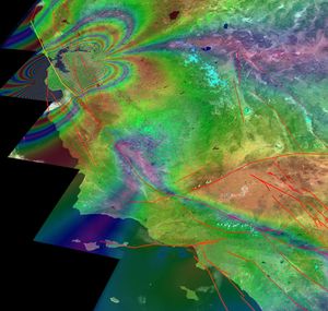
This illustration depicts synthetic aperature radar patterns of seismic deformations associated with a model earthquake on the San Francisco section…
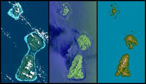
Bora Bora, Tahaa, and Raiatea (top to bottom) are Polynesian Islands about 220 kilometers (135 miles) west-northwest of Tahiti in…
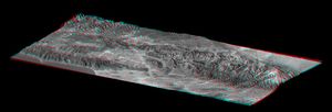
This elevation anaglyph of Los Angeles and adjacent mountainous terrain was created by NASA's Shuttle Radar Topography Mission. 3D glasses…
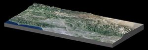
This image from NASA's Shuttle Radar Topography Mission shows the Pacific and Santa Monica Mountains, CA, along Malibu Coast, San…