Envisat
Filters

Blooming Lake Okeechobee
4 min read
Nearly half of the lake was covered with blue-green algae in early July 2022.
Jul 16, 2022
Article

Historic Low Sea Ice in the Bering Sea
4 min read
Warm temperatures and a stormy winter caused sea ice in the Bering Sea to plunge to record lows.
May 3, 2018
Article
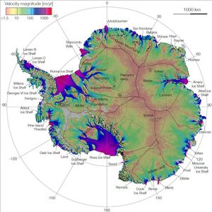
NASA Research Leads to First Complete Map of Antarctic Ice Flows
1 min read
This image is the first complete map of the speed and direction of ice flow in Antartica. The thick black…
Aug 18, 2011
Article
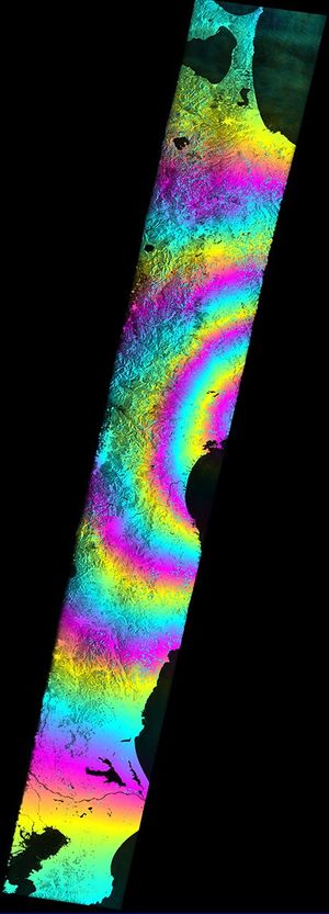
Satellite Radar Measures Tohoku, Japan Earthquake
1 min read
This radar image, called a coseismic interferogram, using satellite data from the European Space Agency's Envisat depicts ground displacements resulting…
Apr 1, 2011
Article
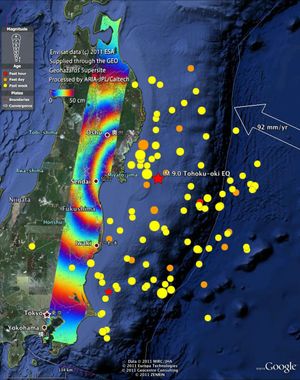
Satellite Radar Measures Tohoku, Japan Earthquake (Google Overlay)
1 min read
This radar image from ESA's Envisat depicts ground displacements resulting from the March 11, 2011, magnitude 9.0 Tohoku earthquake in…
Apr 1, 2011
Article
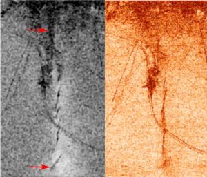
Bam, Iran, Radar Interferometry — Earthquake
3 min read
A magnitude 6.5 earthquake devastated the small city of Bam in southeast Iran on December 26, 2003. The two images…
Jun 25, 2004
Article