![Request for Information – Potential [Placeholder for Prize]](https://assets.science.nasa.gov/dynamicimage/assets/science/missions/a-step/FFR_Earth_Background_20251120%20.png?w=1024)


As the world looks for sustainable solutions, a system tapping into NASA satellite data for water management has passed a critical test.
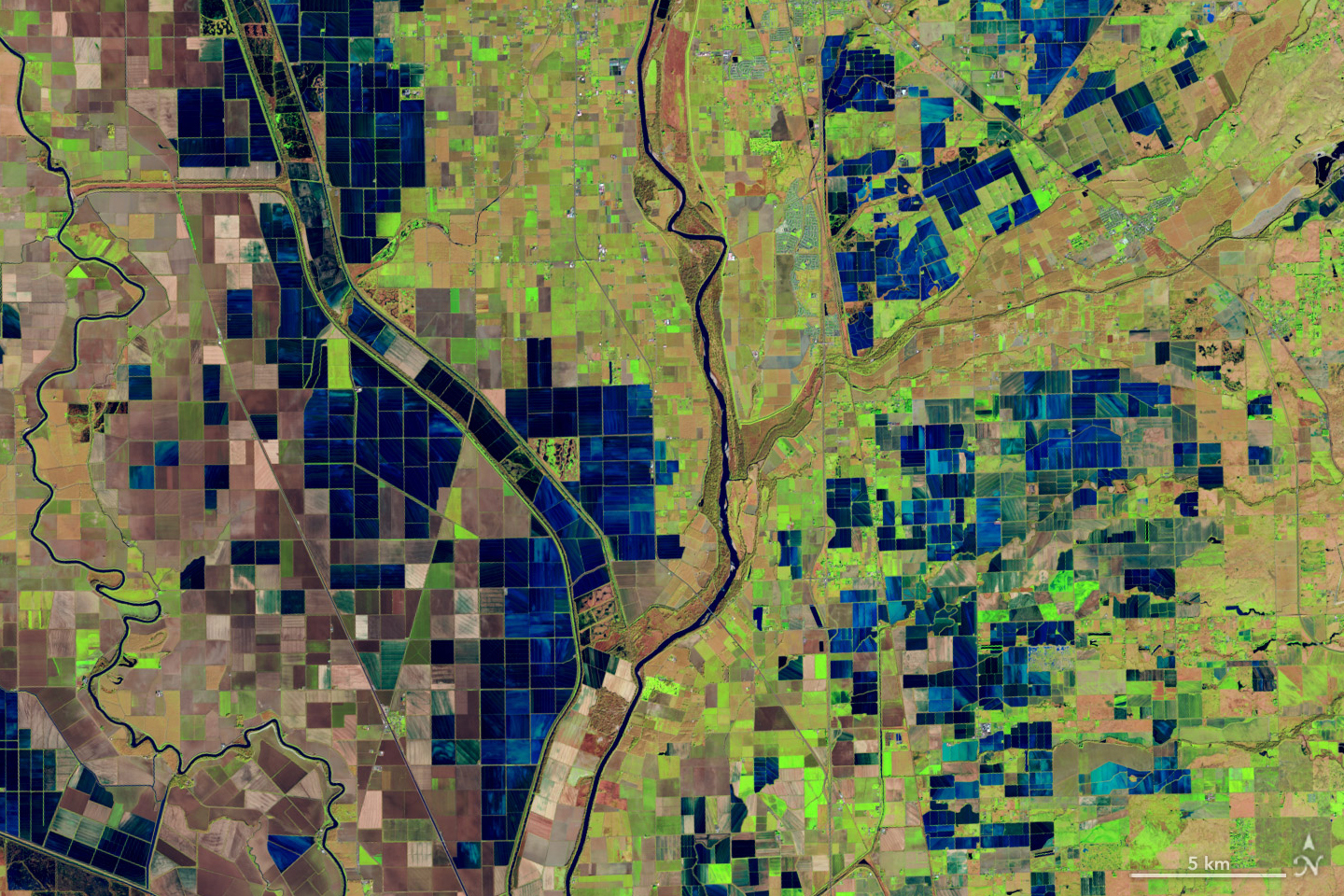
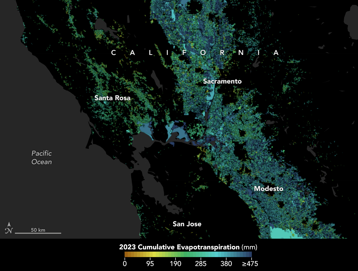
Called OpenET, the system uses an ensemble of six satellite-driven models that harness publicly available data from the Landsat program to calculate evapotranspiration (ET)—the movement of water vapor from soil and plant leaves into the atmosphere. OpenET does this on a field-level scale that is greatly improving the way farmers, ranchers, and water resource managers steward one of Earth’s most precious resources.
Researchers have now conducted a large-scale analysis of how well OpenET is tracking evapotranspiration over crops and natural landscapes. The team compared OpenET data with measurements from 152 sites with ground-based instruments across the United States. In agricultural areas, OpenET calculated evapotranspiration with high accuracy, especially for annual crops such as wheat, corn, soy, and rice. The researchers reported their findings on January 15 in Nature Water.
“I was pleasantly surprised by the results,” said John Volk, lead author of the study and assistant research scientist and software engineer at Desert Research Institute in Reno, Nev. “The accuracy in croplands was quite strong, particularly in western arid regions, which are important areas for agriculture and have water sustainability challenges.”
That’s welcome news for regions where OpenET data is already being put to work. In Northern California’s Sacramento-San Joaquin Delta, water resource managers are using OpenET to help farmers comply with state rules requiring them to report aspects of their water use. The new study “gives us more confidence that these numbers are accurate, and that OpenET is continually improving over time,” said Lindsay Kammeier, a senior engineer with the California State Water Board in Sacramento, who was not involved in the new research.
“ET is notoriously difficult to calculate,” she added. “Having a really accurate number helps us to make decisions to manage the environment, manage for agricultural uses, and manage for urban uses better and from a common understanding.”
Tracking the Invisible Movement of Water
While many people are familiar with what one inch of rainfall means, few stop to think about one inch of evapotranspiration returning to the atmosphere, said Forrest Melton, the OpenET project scientist at NASA’s Ames Research Center in California’s Silicon Valley. “OpenET is working to make the unseen process of evapotranspiration as easy to track as checking the amount of rainfall in the daily weather forecast.”
Evapotranspiration is the natural process in which water moves to the atmosphere from the surface. The term combines evaporation—water changing from liquid to gas (vapor) and rising from soil, lakes, and oceans—and transpiration, the "exhaling" by plants as they release moisture back into the air. After precipitation, evapotranspiration is one of the most important factors for estimating how much water is available for crops or other plants.
For farmers and water managers, accurate data provides a measure of the amount of water required through irrigation to replace the water that has been consumed by evapotranspiration. Knowing precisely how much water is available helps people give plants the moisture they need to flourish, without needing to apply too much. And that, in turn, can help save money for water and for the electricity used to pump water for irrigation.
But all that rising water vapor is invisible, making it difficult and expensive to track on the ground.
Farmers, scientists, and others previously relied on estimates of “potential evaporation” based on temperature, humidity, and other weather data. Or they turned to ground-based stations such as flux towers, equipped with sensors that monitor carbon dioxide, water vapor, and the exchange of heat between Earth’s surface and the atmosphere—a process crucial to calculating evapotranspiration.
But while they tend to be highly accurate, flux towers are expensive to set up and maintain, so there are a limited number, and their data is local and cannot represent wider regions. That’s where calculating evapotranspiration from space comes in. Satellites pass over the same areas regularly, offering consistent monitoring.
OpenET’s primary observations come from the Landsat 8 and 9 satellites, a partnership between NASA and the U.S. Geological Survey. The satellites combine data on land surface temperatures and the greenness of plants, among other things. Cooler land surface temperatures over areas with healthier, denser vegetation, for example, usually indicate higher levels of transpiration.
That data is then fed into models to calculate evapotranspiration at high resolution—about a quarter of an acre for each image pixel.
The new results show that for agricultural lands, OpenET data for monthly, growing season, and annual timescales had an average error rate of about 10-20%.
The OpenET consortium includes NASA, USGS, and the U.S. Department of Agriculture working with Desert Research Institute and nearly a dozen other universities, Environmental Defense Fund, and Google Earth Engine.
For more information, go to: https://openetdata.org/
By: Emily DeMarco, NASA Earth Science Division