


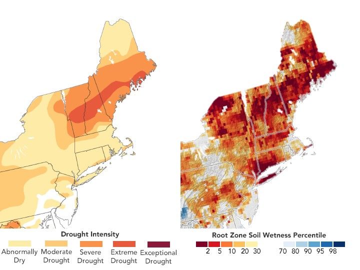
Drought Worsens Across Northern New England
In late September 2025, a continued lack of rainfall led to stunted vegetation, lowered water levels, and prompted early fall foliage.
- X
https://science.nasa.gov/image-detail/amf-d2ca51dc-7f4c-44cf-b6f0-58606b9ea423/
Size720x540px
