Suggested Searches

1 min read

Fires In Alaska and Northern Canada

Instruments:
Topics:
2004-06-24 00:00:00
June 24, 2004

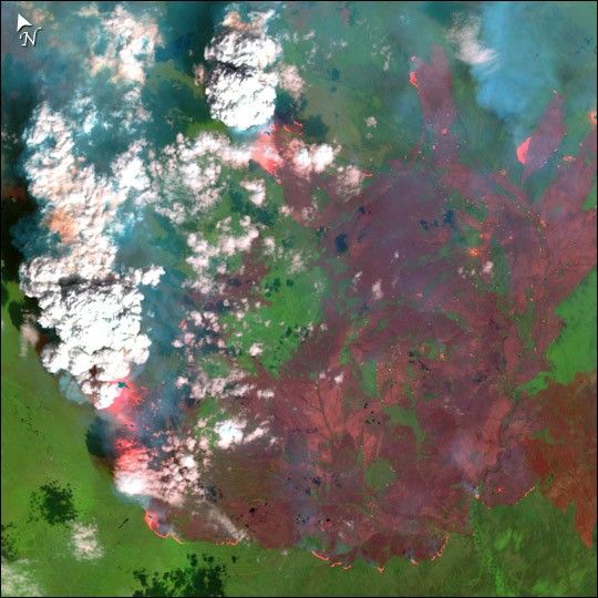
In east-central Alaska, the Pingo Fire was scorching hundreds of thousands of acres north of the Yukon River in early July 2004. This detailed image of the fire on June 24, 2004, shows burned areas as red, unburned vegetation as bright green, and smoke as blue. At the margins of the burned areas, actively burning portions of the fire appear bright pink.

This image was acquired by Landsat 7’s Enhanced Thematic Mapper plus (ETM+) sensor on June 26, 2004. This is a false-color composite image made using shortwave infrared, near infrared, and green wavelengths (ETM+ bands 7, 4, & 2).

References & Resources

Data provided by the USGS EROS Data Center Satellite Systems Branch.

You may also be interested in:

Stay up-to-date with the latest content from NASA as we explore the universe and discover more about our home planet.

Smoke Rises Over Big Cypress National Preserve
2 min read

The National fire has burned tens of thousands of acres within the Florida preserve, fueled by vegetation dried by prolonged…

Article
Fires on the Rise in the Far North
3 min read

Satellite-based maps show northern wildland fires becoming more frequent and widespread as temperatures rise and lightning reaches higher latitudes.

Article
A Golden Moment for Boreal Forests
3 min read

Hillsides in Alaska’s interior showed their changing colors ahead of the autumnal equinox.

Article