
August 28, 2004
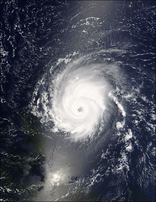
The MODIS instrument aboard NASA's Terra satellite captured this true-color image of Hurricane Frances swirling in the tropical Atlantic Ocean on August 28 at 14:15 UTC (10:15 AM EDT). At the time this image was taken Frances was located approximately 1190 km (740 miles) east of the northern Leeward Islands and was moving towards the northwest at 15 km/hr (9 mph). Maximum sustained winds were near 195 km/hr (120 mph) with an estimated minimum central pressure of 958 mmillibars.
The MODIS Rapid Response System provides this image at additional resolutions and formats.
References & Resources
NASA image courtesy Jacques Descloitres, MODIS Land Rapid Response Team at NASA GSFC.