Suggested Searches

1 min read

Hurricane Ivan

Instruments:
2004-09-14 00:00:00
September 14, 2004

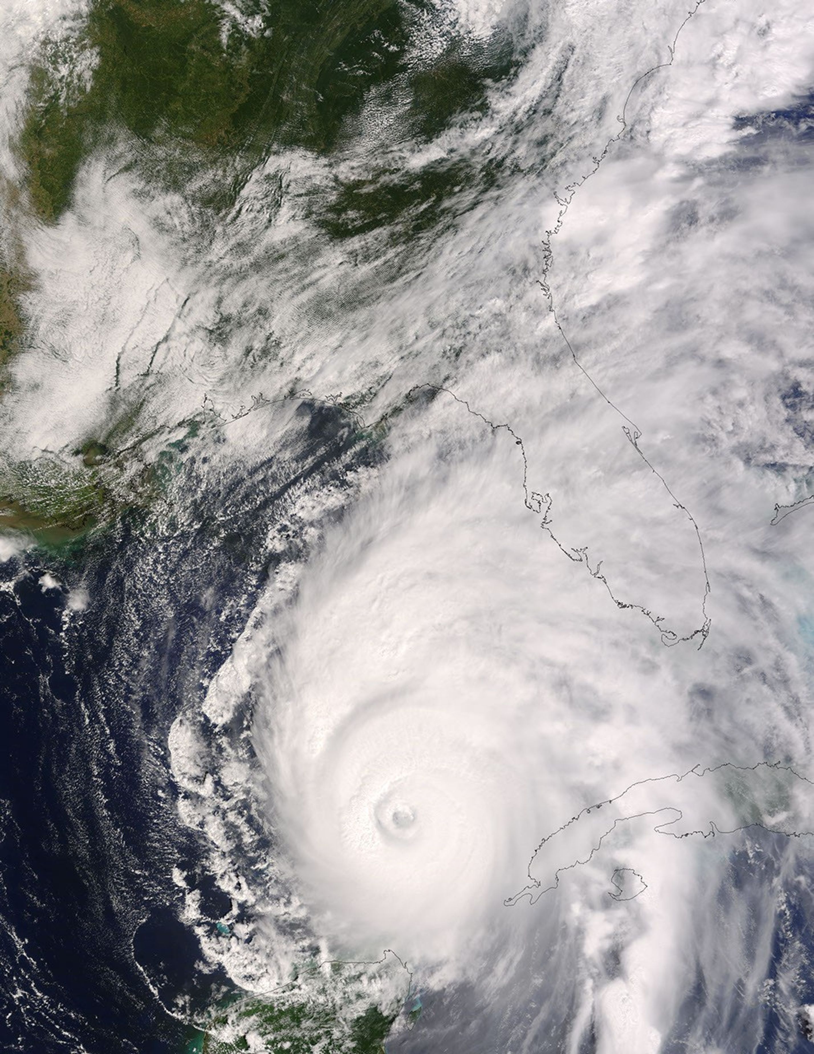
The MODIS instrument flying aboard NASA's Terra satellite captured this true-color image of Hurricane Ivan on September 14, 2004 at 16:35 UTC (12:35 PM EDT). At the time this image was taken Ivan was located approximately 405 miles south-southeast of the Mississippi River and was moving towards the north-northwest at 9 mph. Maximum sustained winds were near 140 mph with higher gusts. Hurricane warnings are expected to go up for portions of the Gulf Coast later today. The above image is available in multiple resolutions.

References & Resources

Image by Liam Gumley, Space Science and Engineering Center, University of Wisconsin-Madison

You may also be interested in:

Stay up-to-date with the latest content from NASA as we explore the universe and discover more about our home planet.

Tropical Storm Arthur
2 min read

The first named storm of the 2026 Atlantic hurricane season brought intense rainfall and the threat of flash flooding to…

Article
Tornado Draws a Jagged Line in Mississippi
3 min read

The strongest of several twisters to touch down in the southern part of the state in early May 2026 left…

Article
Showy Swirls Around Jeju Island
2 min read

Winds blowing past the volcanic landmass near the Korean Peninsula created a trail of spiraling clouds, while murky water churned…

Article