


Exceptional drought has gripped much of Arizona for months. In June 2021, a potent heat wave sent temperatures soaring above 115°F (46°C) on multiple days. Now extreme fires are raging throughout the state.
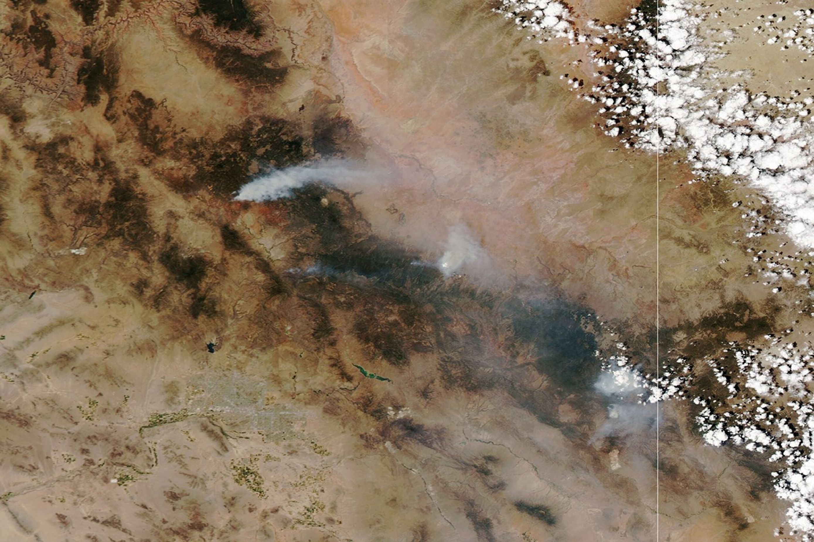
On June 21, 2021, the Moderate Resolution Imaging Spectroradiometer (MODIS) on NASA’s Aqua satellite captured this natural-color image of smoke streaming from several large fires in Arizona.
Dozens of fires were reported in Arizona and New Mexico in June 2021, according to data from the U.S. government fire information website InciWeb. Several blazes ignited when dry lightning struck already parched, heat-stressed landscapes.
Southwest of Flagstaff, the Rafael fire had charred more than 38 square miles (97 square kilometers) as of June 21, 2021. The fire prompted evacuations and road closures in several communities. Near Heber, the Wyrick fire had burned 11 square miles and triggered evacuations orders in Navajo County. In the far eastern part of the state near Alpine, the Horton Complex and Bear fires were generating significant amounts of smoke.
Two national forests—Coconino and Kaibab—in northern Arizona have taken the rare step of closing to protect public safety.
Human greenhouse gas emissions have likely left a fingerprint on the heat wave. “It may look similar to other heat waves on a weather map, but the magnitude, intensity and duration of the event is larger because of climate change,” said Michael Crimmins, a University of Arizona environmental scientist and a co-investigator for the CLIMAS Southwest Climate Assessment, in a perspective article written for The Washington Post.
References & Resources
- Associated Press (2021, June 22) Arizona feeling brunt of wildfire activity across US West. Accessed June 22, 2021.
- Arizona Daily Sun (2021, June 21) Rafael Fire rapidly grew southwest of Flagstaff Sunday as fire managers juggle resources. Accessed June 22, 2021.
- The Arizona Republic (2021) Coconino, Kaibab National Forests are closing. What campers and visitors need to know. Accessed June 22, 2021.
- Inciweb (2021) Incident Information System Accessed June 22, 2021.
- Kabib National Forest (2021, June 21) Full forest closure for the Kaibab National Forest to begin Wednesday morning. Accessed June 22, 2021.
- NASA Earthdata (2021) Wildfires. Accessed June 22, 2021.
- The Washington Post (2021, June 21) Climate change made Arizonaâs heat wave worse. And it wonât be the last one. Accessed June 22, 2021.
NASA Earth Observatory image by Lauren Dauphin, using MODIS data from NASA EOSDIS LANCE and GIBS/Worldview . Caption by Adam Voiland .