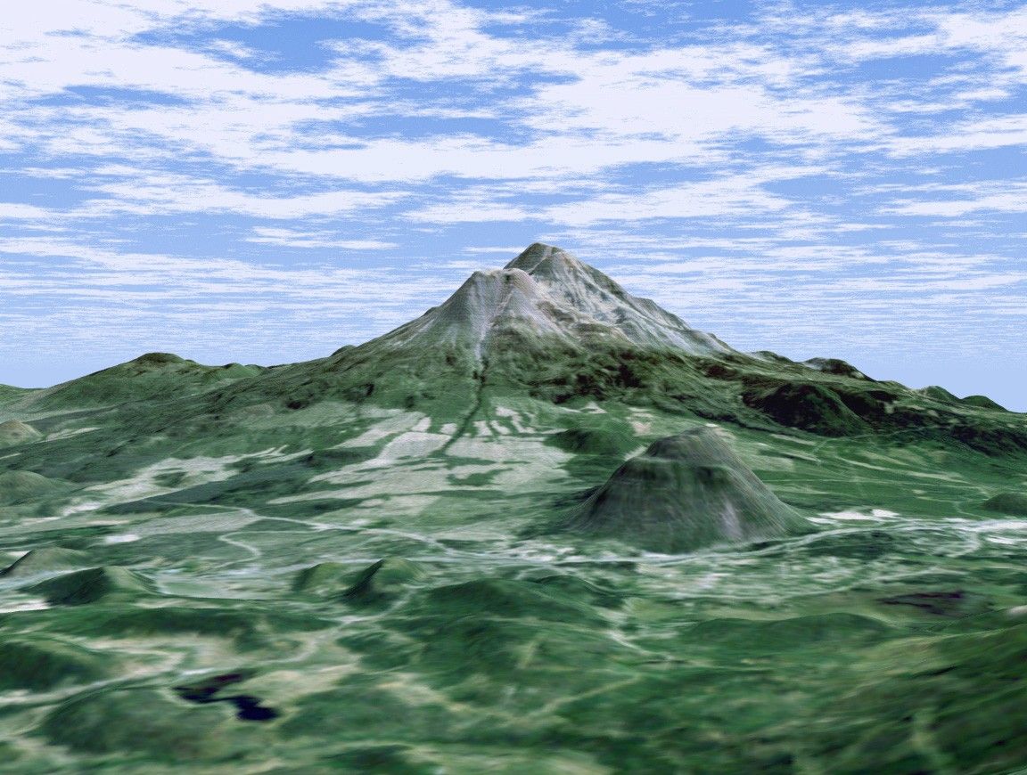
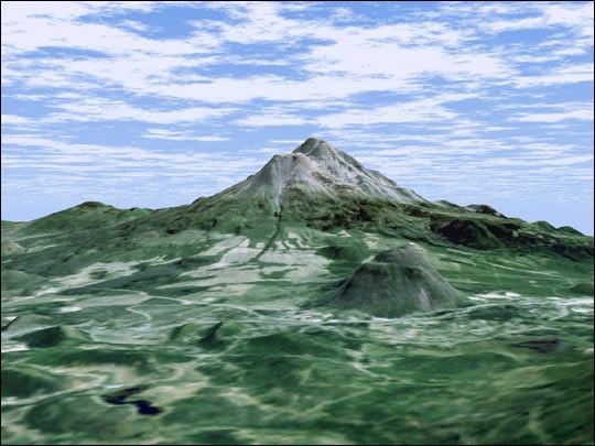
At more than 4,300 meters (14,000 feet ), Mount Shasta is California’stallest volcano and part of the Cascade chain of volcanoes extendingsouth from Washington. This computer-generated perspective viewed fromthe west also includes Shastina, a slightly smaller volcanic cone leftof Shasta’s summit and Black Butte, another volcano in the rightforeground.
This 3-D perspective view was generated using topographic data from theShuttle Radar Topography Mission (SRTM) and an enhanced color Landsat 5satellite image. Topographic expression is exaggerated two times.
Landsat has been providing visible and infrared views of the Earth since1972. SRTM elevation data matches the 30-meter (98-foot) resolution ofmost Landsat images and will substantially help in analyzing the largeand growing Landsat image archive.
Elevation data used in this image was acquired by the Shuttle RadarTopography Mission (SRTM) aboard the Space Shuttle Endeavour, launchedon Feb. 11, 2000.
Size: scale varies in this perspective image
Location: 41.4 deg. North lat., 122.3 deg. West lon.
Orientation: looking east
Image Data: Landsat Bands 3,2,1 as red, green, blue, respectively
Original Data Resolution: SRTM 1 arcsecond (30 meters or 98 feet), Thematic Mapper 1 arcsecond (30 meters or 98 feet)
Date Acquired: February 2000 (SRTM)
For more information, read: Pictures from the Real Edge: NASA Posts U.S. Topography Data.
References & Resources
Image NASA/JPL/NIMA