


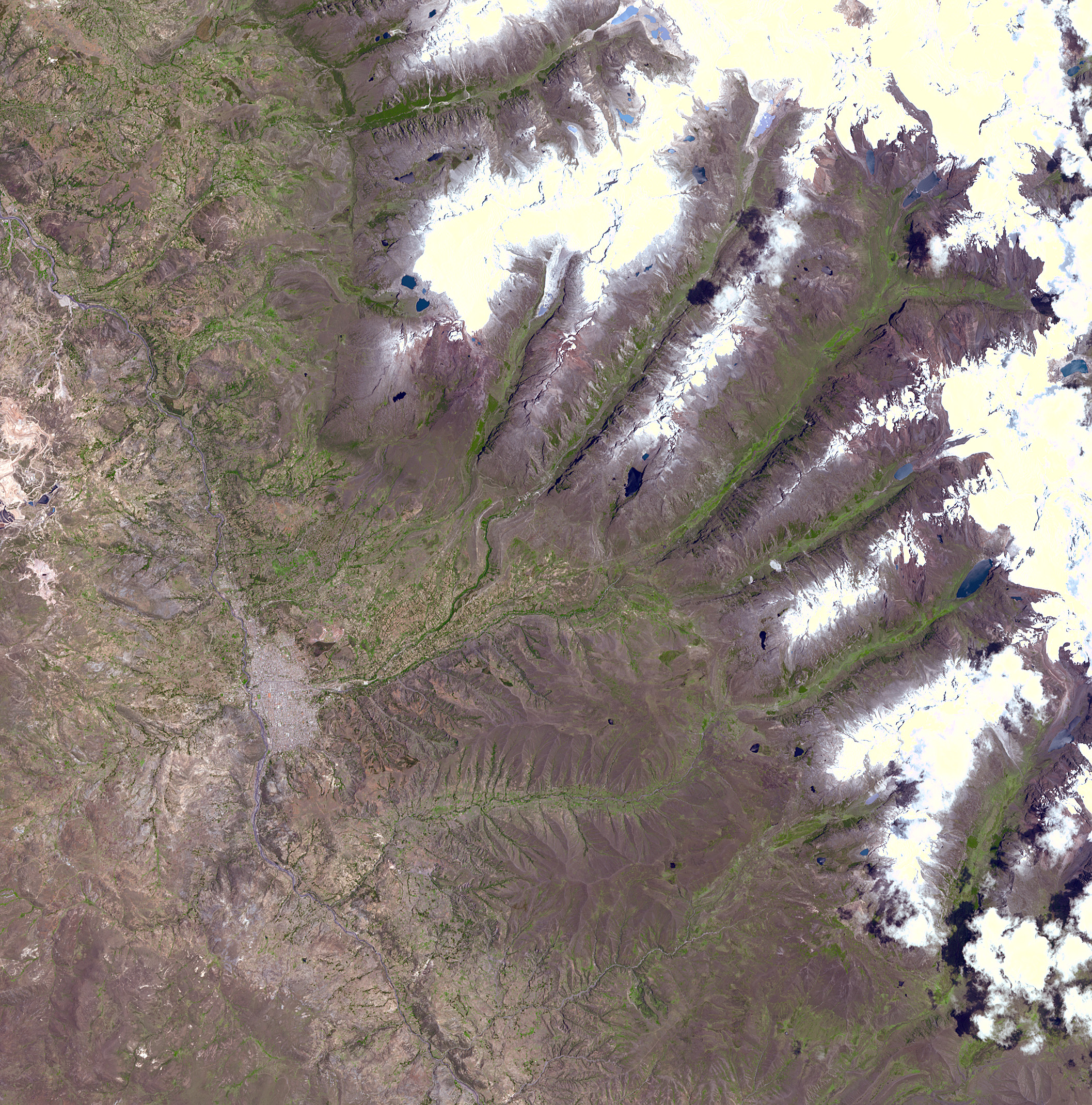
A chunk of glacier was threatening to fall into an Andean lake andcause major flooding in a Peruvian city of 60,000. A fissure hasappeared in the glacier that feeds the Lake Palcacocha near the city ofHuaraz, 270 km north of Lima. If the piece breaks off, ensuing floodswould take 15 minutes to reach the city. In 1941, the lake overflowedand caused massive destruction, killing 7,000 people. The city can beseen in the left-center part of the image. Lake Palcacocha is in theupper right corner of the image at the head of a valley, below the snowand glacier cap. The Advanced Spaceborne Thermal Emission and ReflectionRadiometer (ASTER) instrument, aboard NASA’sTerra satellite, is being tasked to obtain currentimages of the glacier to help monitor the situation.
Size of full-resolution image: 31.8 x 31.8 km (19.7 x 19.7 miles)
Location: 9.5 deg. South lat., 77.5 deg. West long.
Orientation: North at top
Image Data: ASTER bands 1 (green), 2 (red), and 3(near-infrared).
Original Data Resolution: 15 meter
Date Acquired: November 5, 2001
References & Resources
Image courtesy NASA/GSFC/MITI/ERSDAC/JAROS, and U.S./Japan ASTER Science Team


