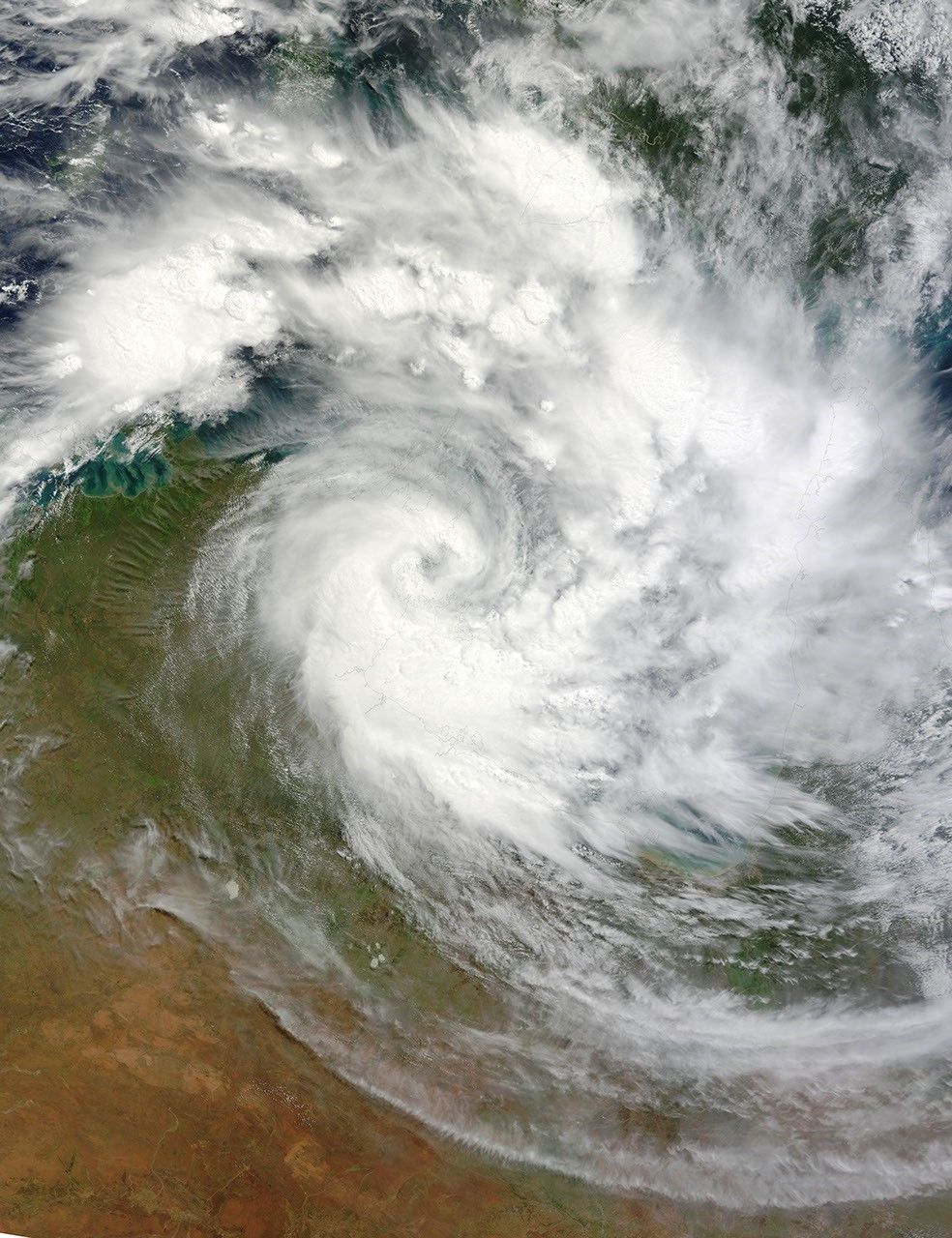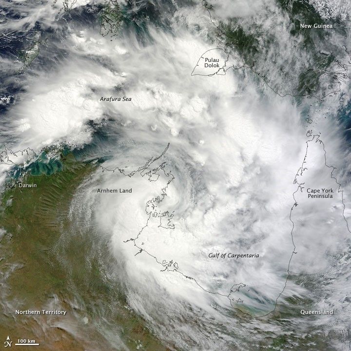
Tropical Cyclone Paul spanned the ocean waters between Australia and New Guinea on March 29, 2010. The Moderate Resolution Imaging Spectroradiometer (MODIS) on NASA’s Terra satellite captured this natural-color image the same day. The center of the cyclone is along the coast of Northern Territory’s Arnhem Land. Clouds run clockwise across the Gulf of Carpentaria and Cape York Peninsula, over New Guinea’s Pulau Dolok, and over the Arafura Sea.
On March 29, 2010, the U.S. Navy’s Joint Typhoon Warning Center (JTWC) reported that Tropical Cyclone Paul storm had maximum sustained winds of 60 knots (110 kilometers per hour) and gusts up to 75 knots (140 kilometers per hour). The storm was located roughly 315 nautical miles (585 kilometers) east of Darwin. The storm had moved slowly toward the southwest over the previous several hours. The JTWC forecast that the storm would likely maintain its current intensity for several more hours before slowly dissipating over land.
References & Resources
- Joint Typhoon Warning Center. (2010, March 29). Tropical Cyclone 22P (Paul) Warning. Accessed March 29, 2010.
NASA image by Jeff Schmaltz, MODIS Rapid Response Team at NASA GSFC. Caption by Michon Scott.