



















June 7, 2010
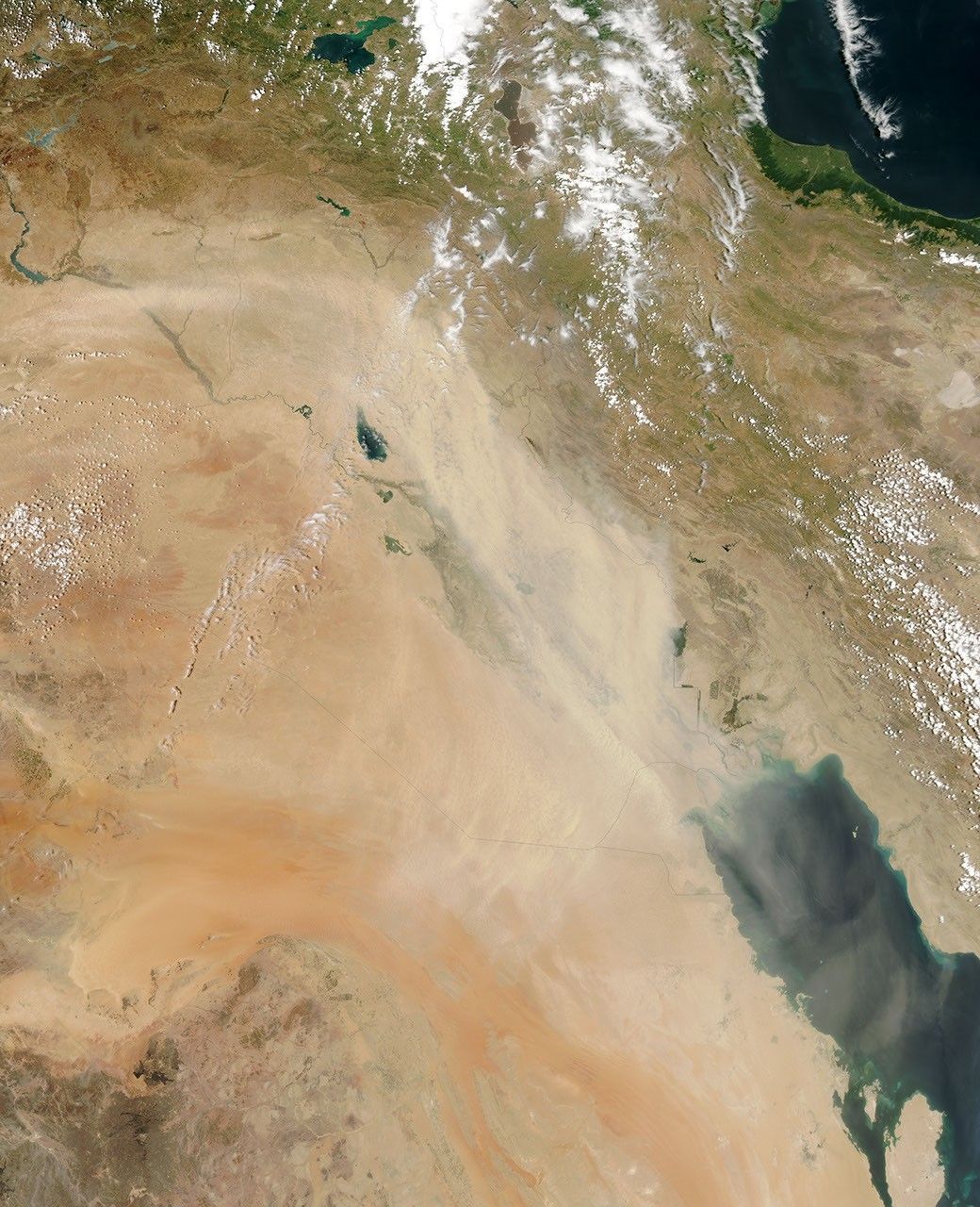
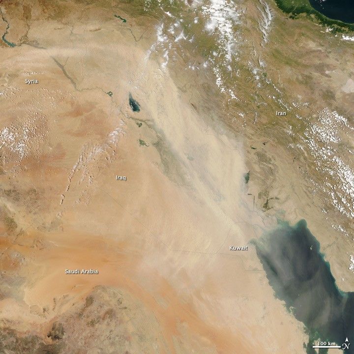
A plume of dust hundreds of kilometers long covered Iraq on June 7, 2010. The light-colored dust follows a course similar to that of the Euphrates and Tigris Rivers across Syria and southeast through Iraq to the Persian (Arabian) Gulf. In places, the thick dust hides the web of green that marks the course of the rivers across the desert.
The Moderate Resolution Imaging Spectroradiometer (MODIS) on NASA’s Aqua satellite captured this photo-like image on the afternoon of June 7. The large image is the highest-resolution version of the image, but the image is available in additional resolutions from the MODIS Rapid Response System.
References & Resources
NASA image courtesy Jeff Schmaltz, MODIS Rapid Response Team at NASA GSFC. Caption by Holli Riebeek.