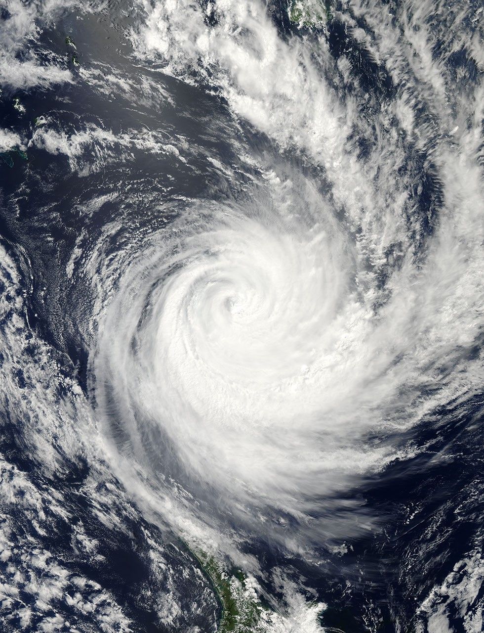
Tropical Cyclone Atu approached the North Island of New Zealand on February 23, 2011. The U.S. Navy’s Joint Typhoon Warning Center (JTWC) reported that, as of 10:00 p.m. Auckland time on February 23, Atu was located roughly 505 nautical miles (935 kilometers) north-northeast of the city. The storm had maximum sustained winds of 70 knots (130 kilometers per hour) and gusts up to 85 knots (155 kilometers per hour).
The Moderate Resolution Imaging Spectroradiometer (MODIS) on NASA’s Aqua satellite captured this natural-color image around 3:10 p.m. local time on February 23, 2011. One of Atu’s spiral arms extends over New Zealand’s North Island.
The JTWC reported that Atu was currently transitioning to an extra-tropical storm, and forecast that the storm would weaken thanks to reduced sea surface temperatures and increased vertical wind shear. Atu was nevertheless expected to remain strong as it became an extra-tropical low.
References & Resources
- Joint Typhoon Warning Center. (2011, February 23). Tropical Cyclone 17P (Atu) Warning. Accessed February 23, 2011.
NASA image courtesy Jeff Schmaltz, MODIS Rapid Response Team at NASA GSFC. Caption by Michon Scott.