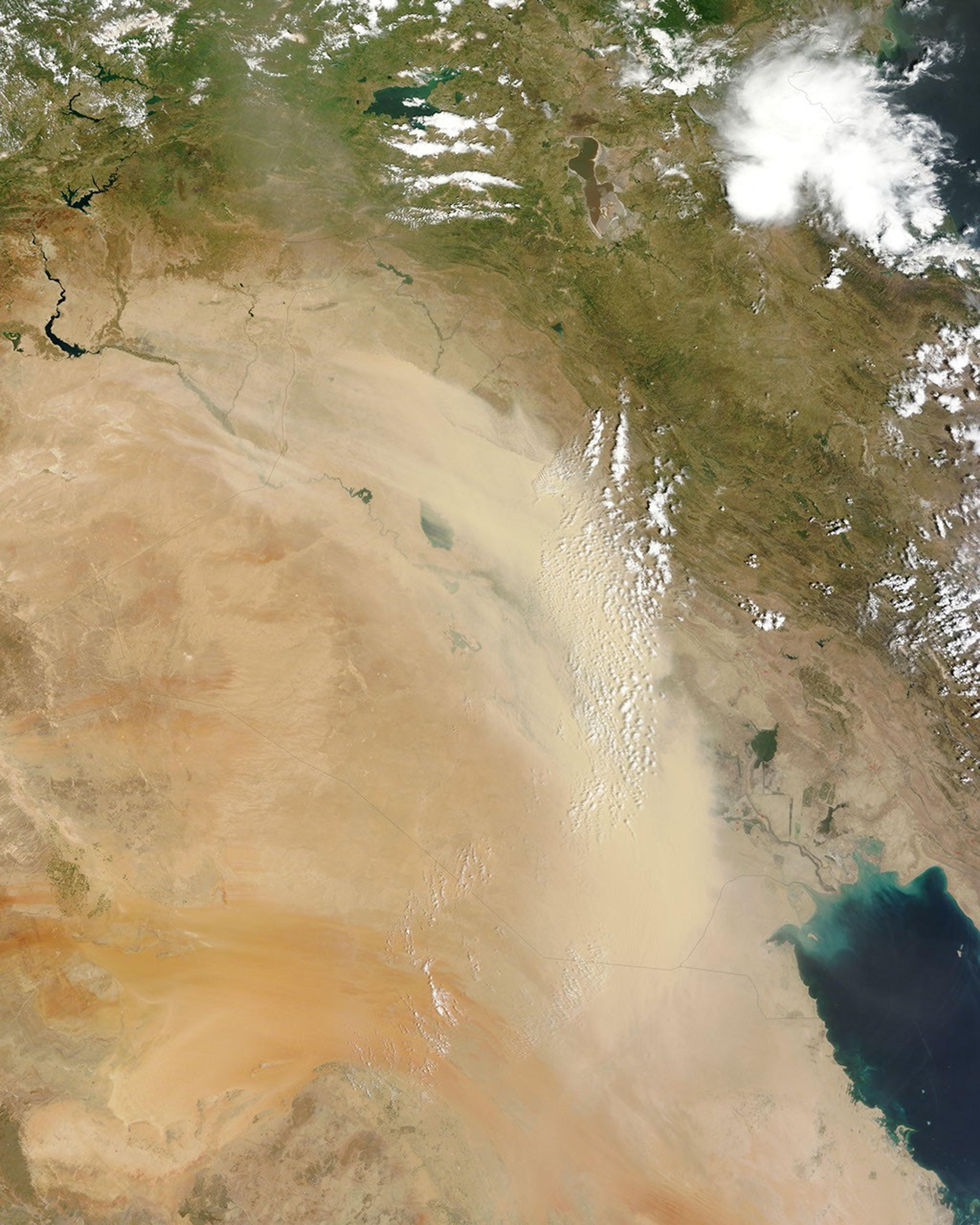



















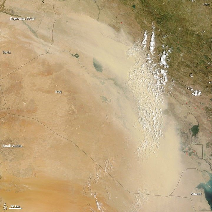
A thick dust plume blew over Iraq on June 2, 2011, stopping just short of Iran and Kuwait. The Moderate Resolution Imaging Spectroradiometer (MODIS) on NASA’s Terra satellite captured this natural-color image the same day.
The dust forms a giant beige arc that obscures most of Iraq. At least some of the dust storm appears to originate in Syria, where sandy desert sprawls over the landscape on either side of the Euphrates River. Dust also arises east of the Syria-Iraq border.
Fine sediments of river basins in Iraq make this area one of the world’s leading dust-producing regions. Rising temperatures in the summertime increase the likelihood of dust storms. High temperatures make the air near the ground unstable, increasing the chance that even a light breeze will loft dust into the air.
References & Resources
- References
- University Corporation for Atmospheric Research. Forecasting Dust Storms. (Registration required.) Accessed June 2, 2011.
NASA image courtesy Jeff Schmaltz, MODIS Rapid Response Team at NASA GSFC. Caption by Michon Scott.