


- September 16, 2005 (3.2 MB)
- October 15, 2004 (3.6 MB)
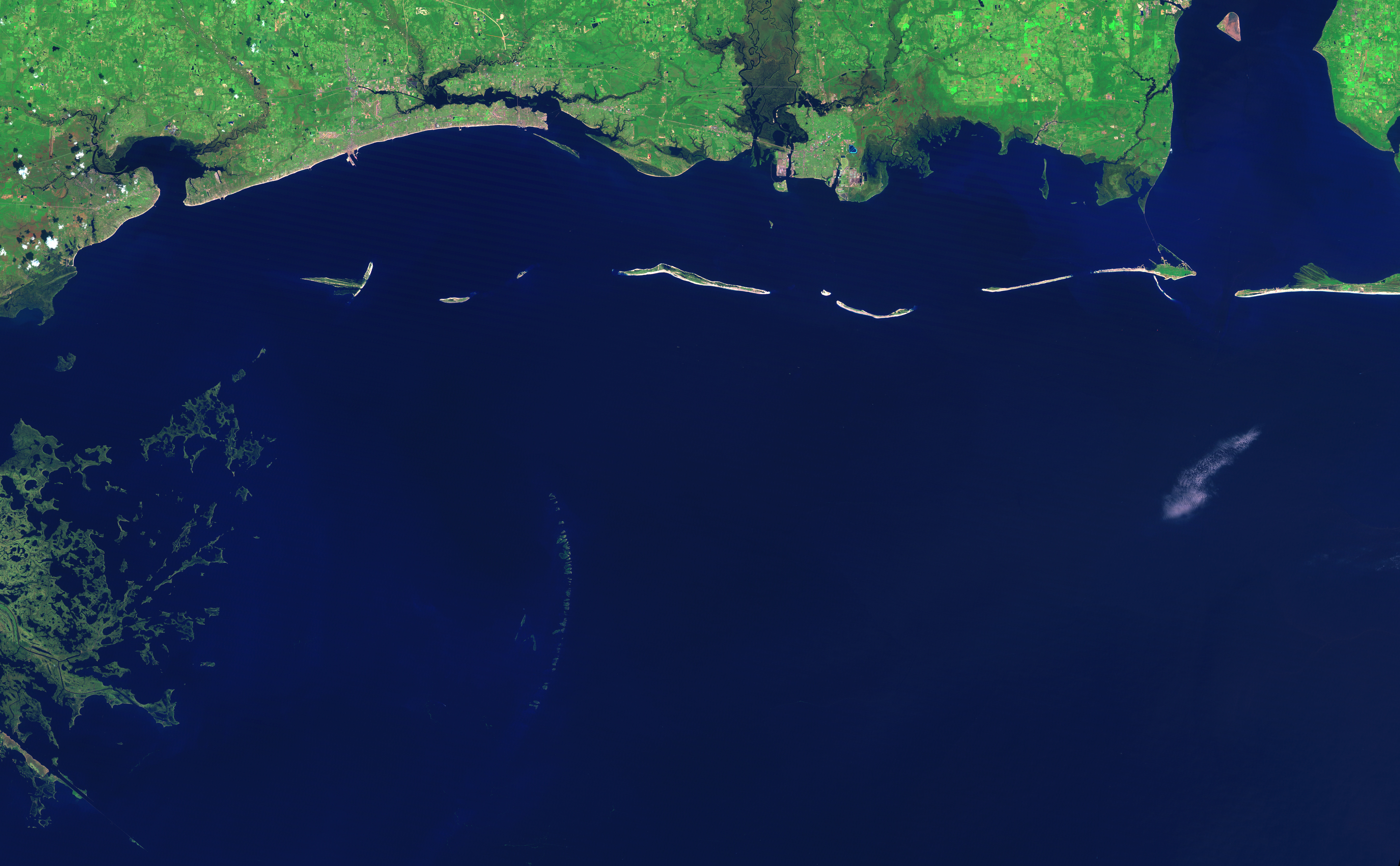
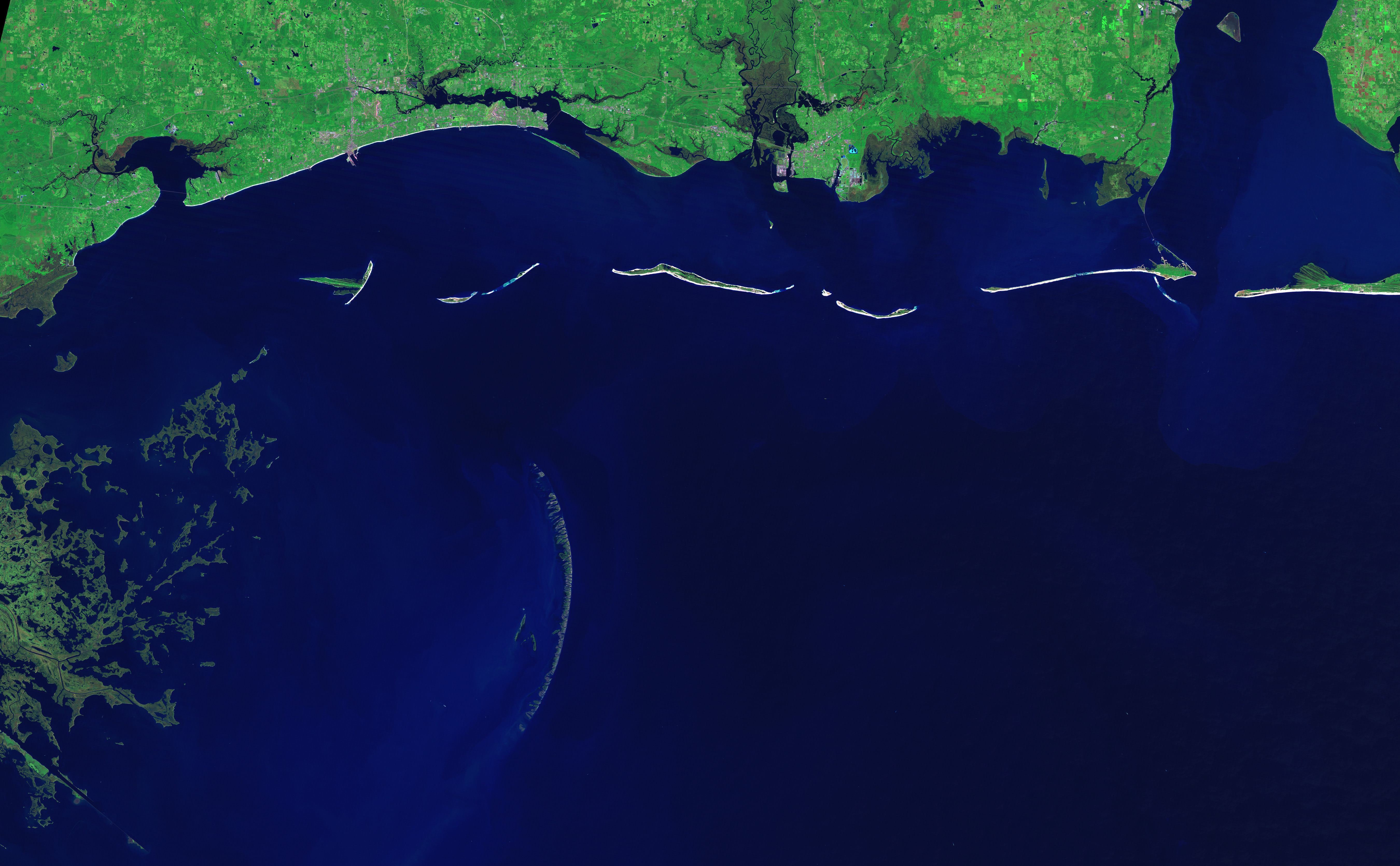
The graceful curve of the Chandeleur Islands resembles a multi-boned spine connecting the Mississippi Gulf coast to the delta of the Mississippi River in Louisiana. Like all barrier islands, the Chandeleur Islands form a thin protective wall between the open sea and the mainland, in this case Louisiana’s St. Bernard Parish. The islands absorb the strongest waves, sheltering the mainland during large storms. It is no surprise, then, that barrier islands along the U.S. Gulf Coast changed dramatically in the wake of Hurricane Katrina, and no change is as dramatic as that seen in the Chandeleur Islands.
Hurricane Katrina’s strong winds, storm surge, and battering waves scoured the islands, leaving them reduced or gone altogether. These images of the islands were taken by the Landsat 5 satellite. The top image, taken on September 16, 2005, shows the Mississippi and Alabama coast line, including the line of islands that bore the brunt of Katrina’s fury. The lower images show the northern section of the Chandeleur Islands at full resolution. In the 11 months that passed between October 15, 2004, when the right image was taken, and September 16, 2005, when the left image was taken, the islands have wasted away.
Barrier islands like the Chandeleur Islands are constantly building, eroding, and shifting under the normal actions of wind and waves. A powerful storm like Katrina can produce changes that otherwise may have taken many years, and most of the change seen here is probably a result of Katrina. Hurricane Dennis also gave the islands a glancing blow on July 10, 2005, and may be responsible for some of the change.
The other barrier islands shown in the top image were also scoured by Katrina. The large images show that the Ship Islands are now significantly smaller than they were in 2004, and Dauphin Island has been cut in two. To read more about Katrina’s impact on the Gulf Coast, please visit the United States Geological Survey’s Hurricane Katrina Impact Studies page. To learn how NASA technology is contributing to our understanding of coastal erosion, see “LIDAR: In the Wake of the Storm” on the Earth Observatory.
References & Resources
NASA image created by Jesse Allen, Earth Observatory, using data provided courtesy of Laura Rocchio, NASA Landsat Project Science Office
None


