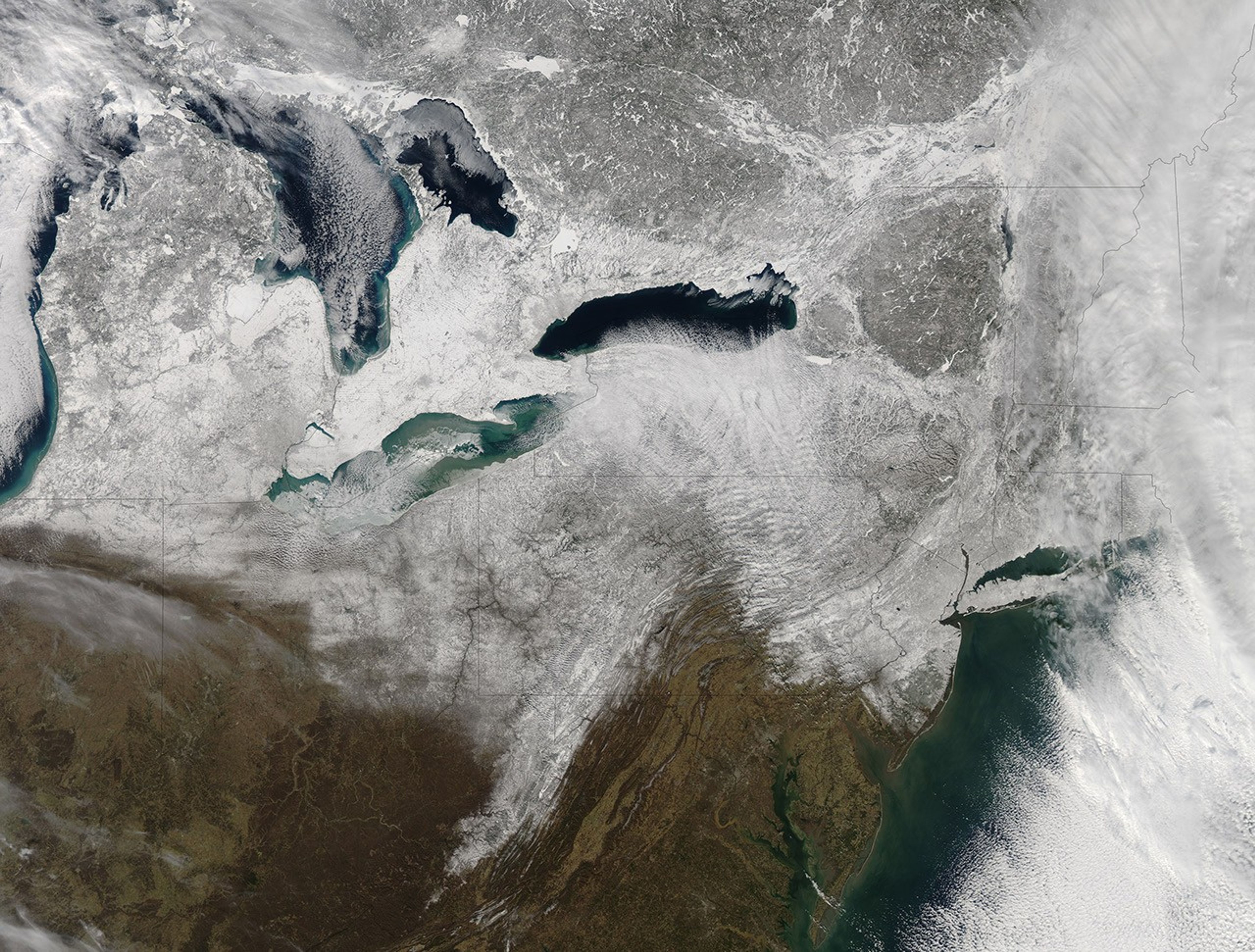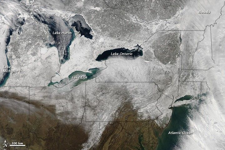
A nor’easter struck the northeastern United States on February 8–9, 2013, depositing snow across multiple states. After the clouds cleared on February 9, the Moderate Resolution Imaging Spectroradiometer (MODIS) on NASA’s Aqua satellite captured this natural-color image. Snow blanketed the ground from the East Coast westward past the Great Lakes, and a band of snow stretched southward into West Virginia.
The powerful storm brought not only heavy snow but also strong winds, downing trees and power lines along the U.S. East Coast. Some of the heaviest snowfall occurred in New England, with some areas receiving nearly 3 feet (1 meter) of snow, according to unofficial totals released by the National Weather Service.
References & Resources
- National Oceanic and Atmospheric Administration. (2013, February 7) Know the dangers of nor’easters. Accessed February 11, 2013.
- National Weather Service. (2013, February 10) Public Information Statement: Spotter Reports. Accessed February 11, 2013.
NASA image courtesy Jeff Schmaltz, LANCE MODIS Rapid Response. Caption by Michon Scott.