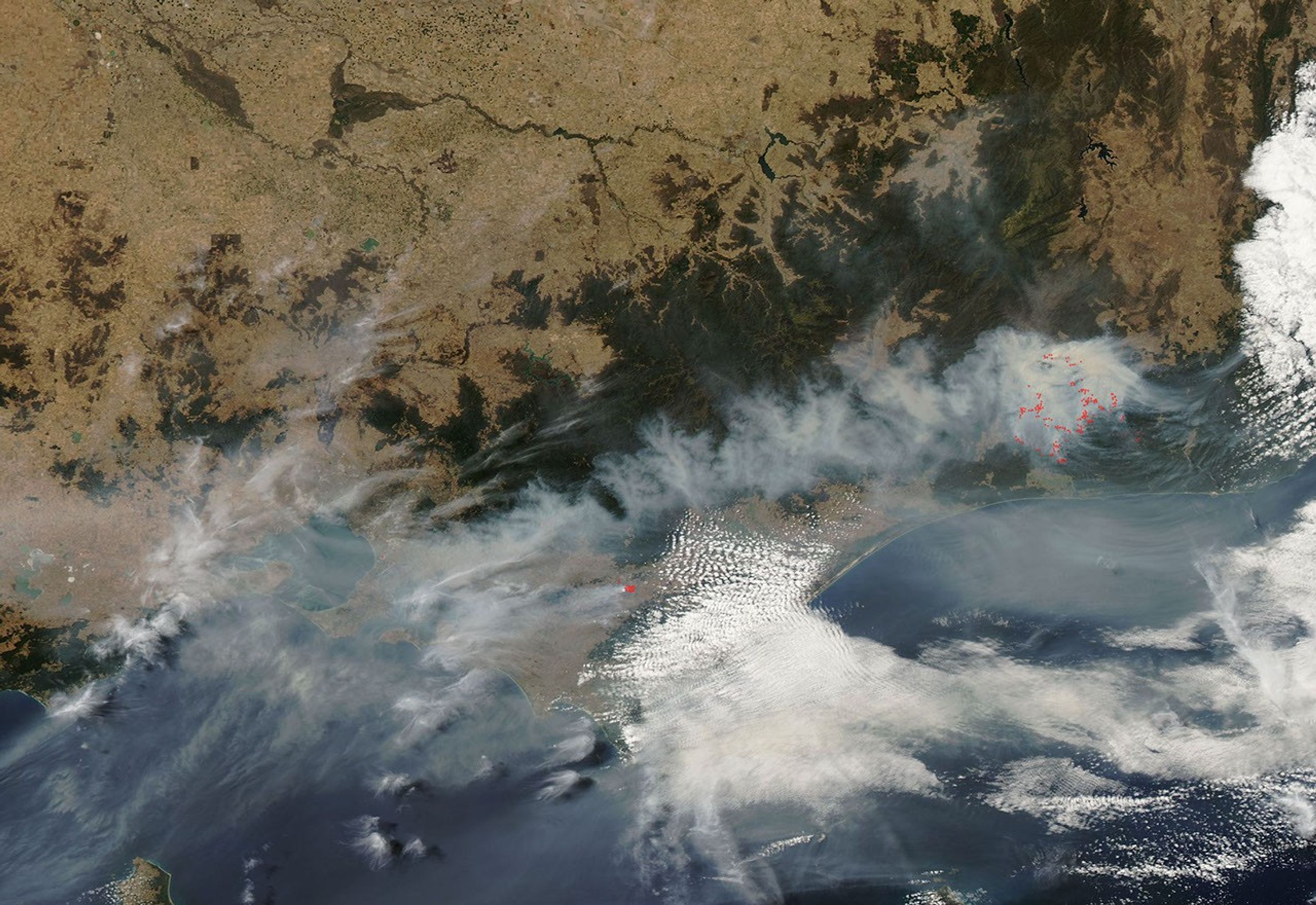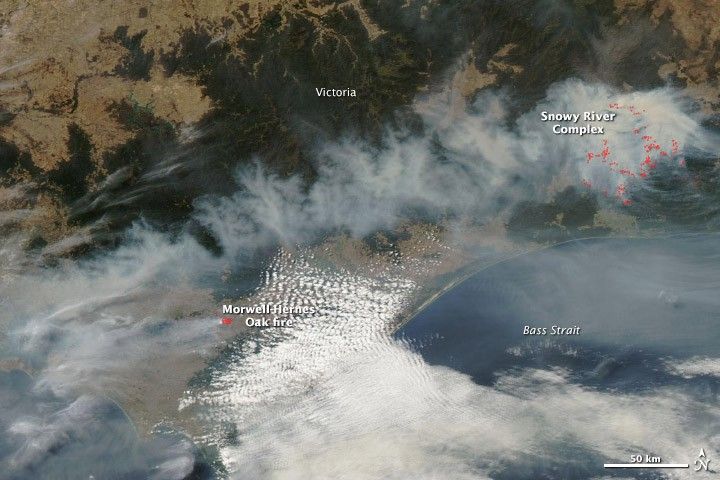
Southeastern Victoria was cloaked in smoke on February 11, 2014, when the Moderate Resolution Imaging Spectroradiometer (MODIS) on NASA’s Aqua satellite acquired this image. Most of the smoke is coming from the Snowy River Complex fire. Lightning ignited several fires in this remote region, and they blew up on February 9. Together, the fires have burned more than 100,000 hectares.
To the west, the Morwell-Hernes Oak Fire was smaller (4,435 hectares) as of February 11. However, the fire was more serious because it posed a threat to several communities in LaTrobe Valley, including Morwell, Hernes Oak, Driffield, and Hazelwood. The fire burned into an open coal mine and at one point threatened the electricity supply for much of Victoria. Smoke also reduced visibility enough to close roads in the region.
References & Resources
- The New Zealand Herald (2014, February 11) Fire crews flat out despite cool shift in weather. Accessed February 11, 2014.
- Ninemsn (2014, February 10) Fire risk subsides in Vic’s Gippsland. Accessed February 11, 2014.
- VicEmergency (2014, February 11) Incidents and warnings. Accessed February 11, 2014.
NASA image LANCE/EOSDIS MODIS Rapid Response Team at NASA GSFC. Caption by Holli Riebeek.