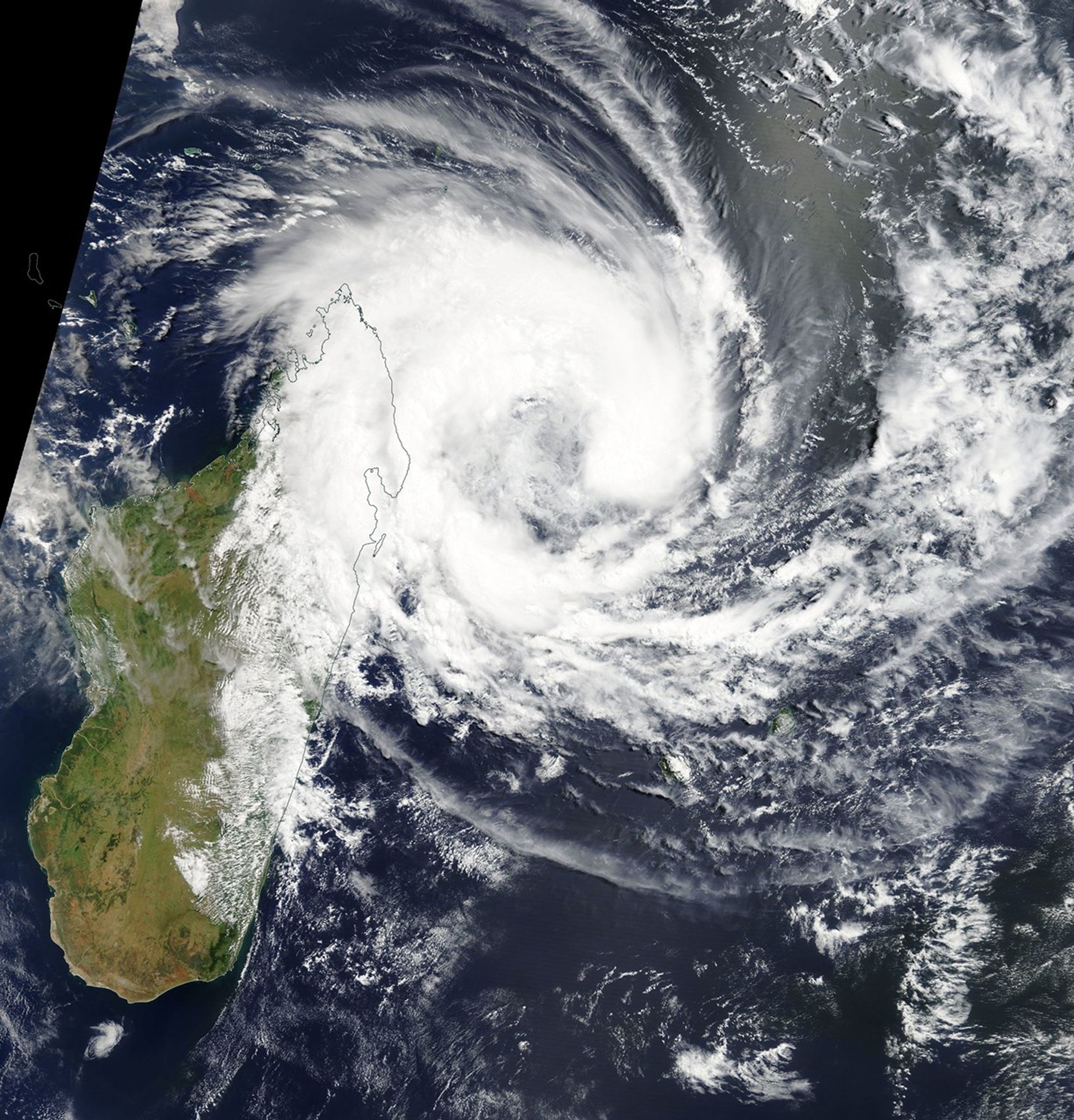




















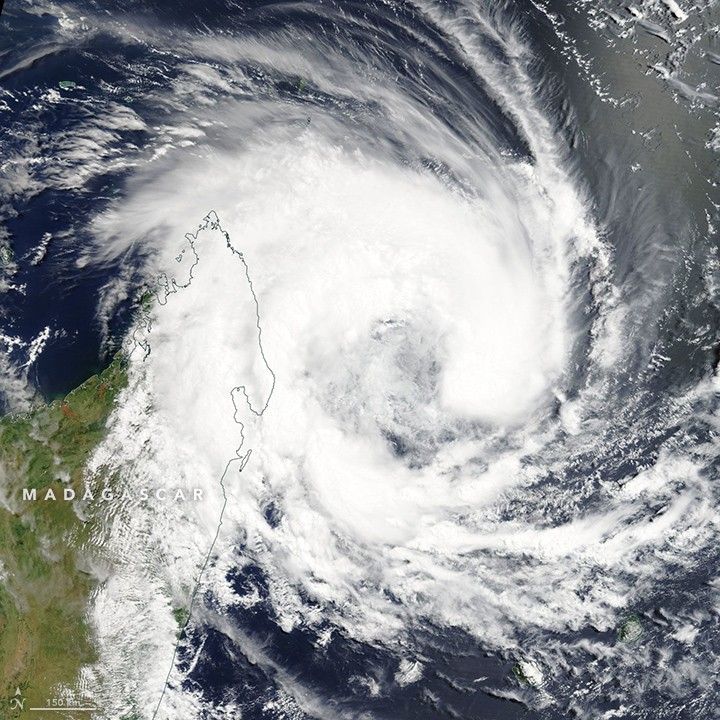
This natural-color image was captured by the Moderate Resolution Imaging Spectroradiometer (MODIS) on NASA’s Terra satellite as tropical storm Eliakim approached Madagascar on March 15, 2018.
Forecasters project that the storm will strike northeast Madagascar at about 9:00 a.m. local time (06:00 UTC) on March 16, 2018, with sustained winds reaching up to 83 kilometers (52 miles) per hour. On March 15, Eliakim was moving west-southwest at about 13 kilometers (8 miles) per hour. During the past 24 hours, a band of strong convection wrapped around the circulation center, which increased the storm’s intensity.
After making landfall, Eliakim will likely continue west-southwest until gradually shifting to the southeast. The weakened storm will then move back over the sea.
References & Resources
- The Watchers (2018, March 15) Tropical Cyclone “Eliakim” to make landfall over NE Madagascar. Accessed March 15, 2018.
- Thomas Reuters Foundation (2018, March 15) Tropical storm Eliakim is forecast to strike Madagascar at about 06:00 GMT on 16 March. Accessed March 15, 2018.
- Weather Underground (2018, March 15) Tropical Cyclone Eliakim. Accessed March 15, 2018.
NASA Earth Observatory image and caption by Asher Ward, using MODIS data from NASA Worldview .