October 17, 2014
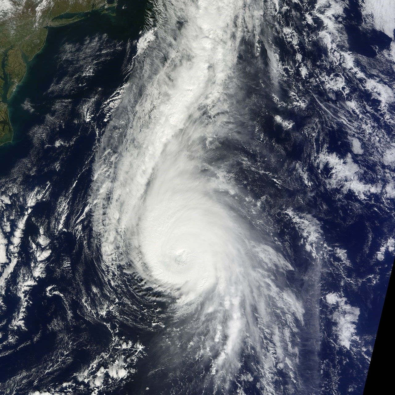
The Moderate Resolution Imaging Spectroradiometer (MODIS) on NASA’s Terra satellite acquired this natural-color image of Hurricane Gonzalo at 11:15 a.m. Atlantic Daylight Time (1515 Universal Time) on October 17, 2014. At the time, the category 3 hurricane had sustained winds of 110 knots (125 miles or 205 kilometers per hour) and a central pressure of 947 millibars.
In the image, Bermuda is hidden under clouds, but the coast of North Carolina is visible in the far upper left.
Read more about this storm in our Image of the Day.
References & Resources
NASA Earth Observatory image by Jesse Allen, using data from the Land Atmosphere Near real-time Capability for EOS (LANCE). Caption by Mike Carlowicz.