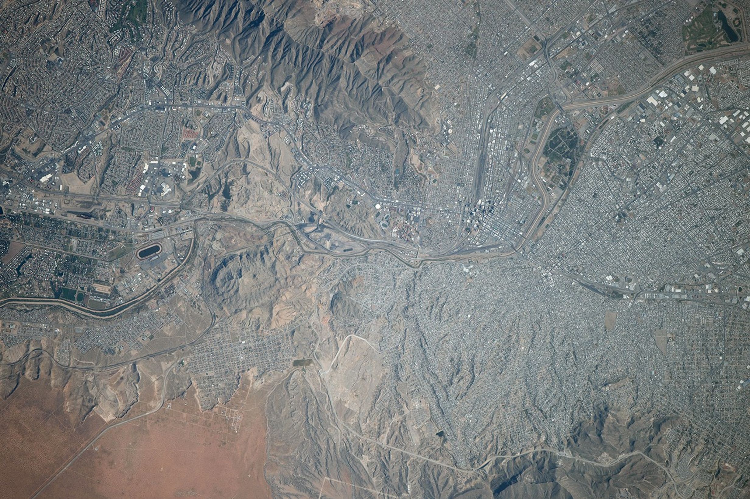


While flying over the border between Mexico and the United States, an astronaut aboard the International Space Station photographed these sister cities on the Rio Grande. The image shows the second largest metropolitan area (population 2.7 million people) on the Mexico–U.S. border. The centers of El Paso and Ciudad Juárez (image top right) lie close together on opposite sides of the Rio Grande, and large residential areas cover the arid slopes in the rest of the scene. The river crosses the entire image as a prominent line and acts as the international border. (Note that north is to the left in this image.) A large, elliptical race track appears on the far left.
The name El Paso refers to a pass or gap in the mountains cut by the Rio Grande (known as the Rio Bravo del Norte in Mexico). This narrow pass divides the Franklin Mountains (image upper margin) from hills in Mexico. The prominent hill Sierra de Cristo Rey (with its statue of Christ) stands on the border. The pass at El Paso has been important for transportation for centuries. Several railroads converged on El Paso in the 1880s, and the curved line of one of them can be seen climbing out of the gap (image lower left). The transcontinental interstate highway—which joins Florida to southern California—also cuts through the gap in downtown El Paso.
References & Resources
Astronaut photograph ISS041-E-103711 was acquired on October 28, 2014, with a Nikon D4 digital camera using an 800 millimeter lens, and is provided by the ISS Crew Earth Observations Facility and the Earth Science and Remote Sensing Unit, Johnson Space Center. The image was taken by the Expedition 41 crew. It has been cropped and enhanced to improve contrast, and lens artifacts have been removed. The International Space Station Program supports the laboratory as part of the ISS National Lab to help astronauts take pictures of Earth that will be of the greatest value to scientists and the public, and to make those images freely available on the Internet. Additional images taken by astronauts and cosmonauts can be viewed at the NASA/JSC Gateway to Astronaut Photography of Earth. Caption by M. Justin Wilkinson, Jacobs at NASA-JSC.