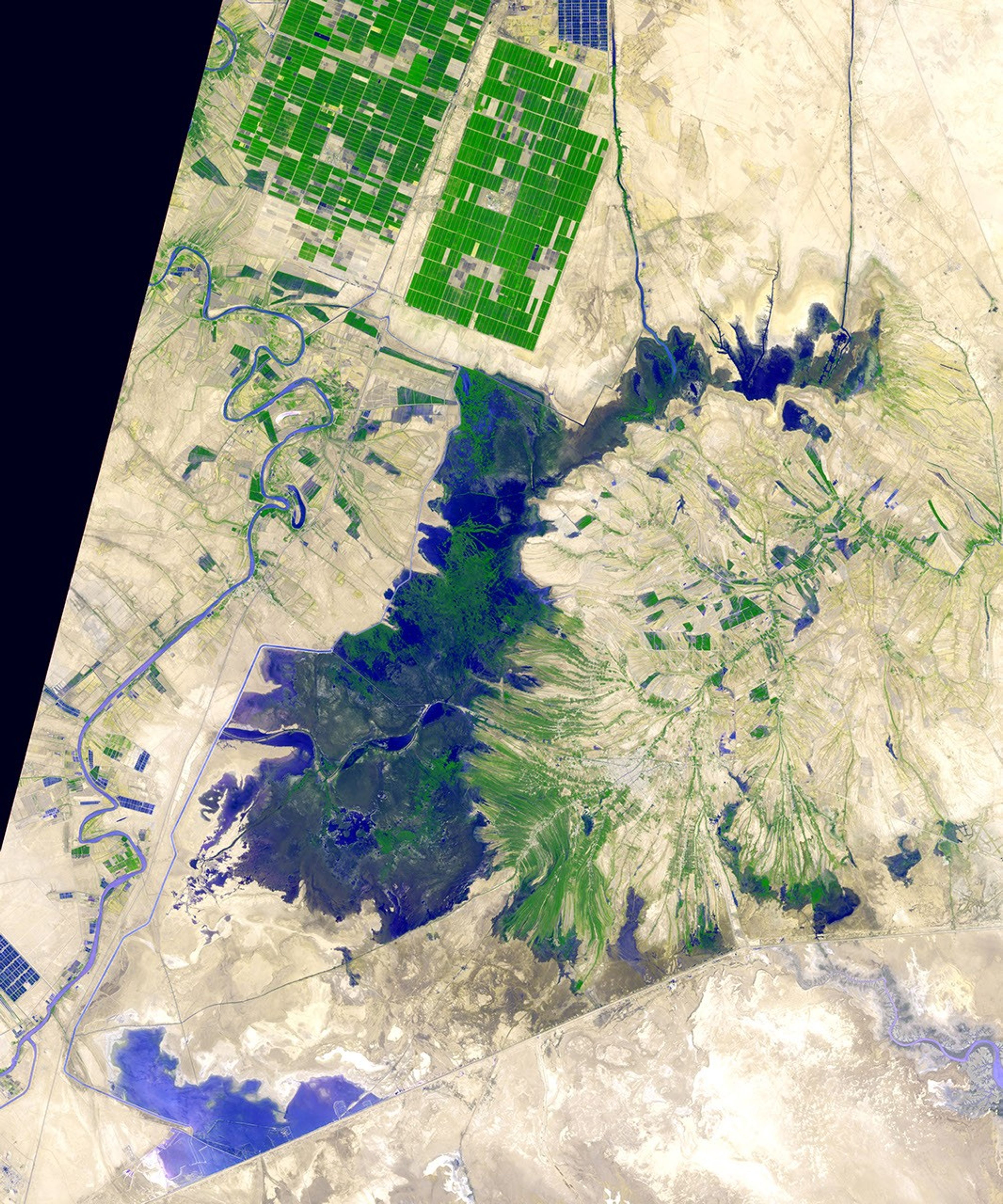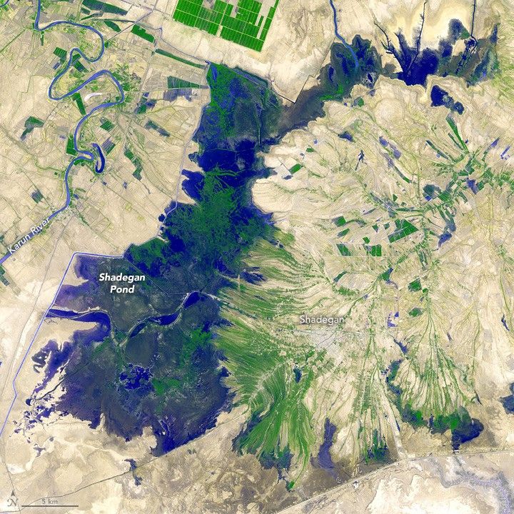
Covering about 400,000 hectares (1 million acres) in Iran’s Khuzestan province, the Shadegan wetlands are the largest in Iran. At their center is Shadegan Pond, a large but shallow body of water surrounded by a varied landscape of sugar plantations, date palm orchards, small towns, and military fortifications.
The Advanced Spaceborne Thermal Emission and Reflection Radiometer (ASTER) on NASA’s Terra satellite captured this image of the pond on September 3, 2012. The Karun River winds along its western edge. Fields of sugar cane stand northwest of it. The town of Shadegan—which is flanked by long, narrow orchards—lies to its east.
Environmental conditions at the wetlands vary throughout the year. In the fall and winter, rains in the Zagros Mountains send water flooding through an intricate series of shallow lagoons and marshes. Many of these areas dry out during the summer months. This image was acquired in the fall, when the area was relatively dry.
The Shadegan wetlands support an array of living things. Sheep, cattle, and water buffalo roam the area, while Mesopotamian himri, carp, and catfish are commonly caught in the pond’s waters. Dozens of bird species—including several types of ducks, terns, gulls, and egrets—can be found in Shadegan Wildlife Refuge.
The refuge is one of the most important sites in the world for the marbled teal, a diving duck. Shadegan supports about 10,000 to 20,000 of these birds in the winter, about half of the world’s population.
References & Resources
- Akhgari, M. (2013, August 21) Marine Ecotourism in Shadegan wetland. Journal of Marine Science: Research & Development.
- The Guardian (2015, April 16) How Iran’s Khuzestan went from wetland to wasteland. Accessed February 10, 2017.
- Kaffashi, S. et al. (2011, May 17) Economic valuation of Shadegan International Wetland, Iran: notes for conservation. Regional Environmental Change, 11 (4), 925-934.
- Travestyle (2016, January 24) Photo Essay: Life By The Shadegan Lagoon. Accessed February 10, 2017.
- UNDP (2011, March) Shadegan Wetland Management Plan. Accessed February 10, 2017.
NASA Earth Observatory image by Jesse Allen, using data from NASA/GSFC/METI/ERSDAC/JAROS, and U.S./Japan ASTER Science Team . Caption by Adam Voiland.