Suggested Searches

1 min read

Fires in Southern Asia

Instruments:
Topics:
2017-04-12 00:00:00
April 12, 2017

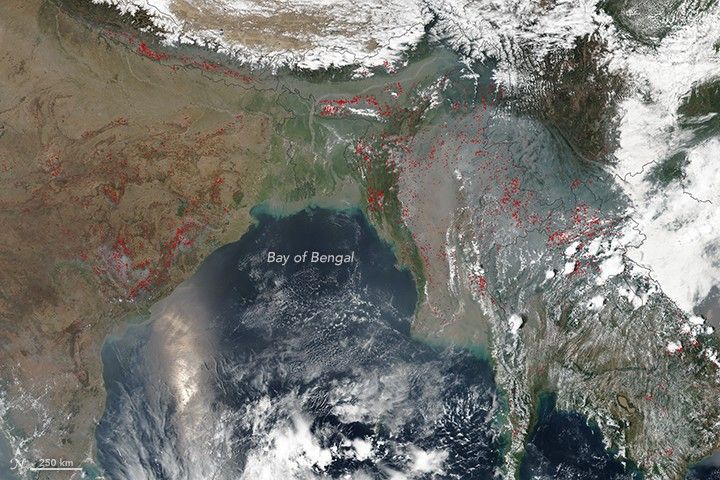
On April 12, 2017, the Visible Infrared Imaging Radiometer Suite (VIIRS) on the Suomi NPP satellite captured this natural-color image of fire and smoke in South and Southeast Asia.

The red outlines are areas where the satellite detected heat signatures indicative of active burning. Many fires in this region are set intentionally for agriculture and land clearing purposes.

References & Resources

NASA image by Jeff Schmaltz, LANCE/EOSDIS Rapid Response. Caption by Kathryn Hansen.

You may also be interested in:

Stay up-to-date with the latest content from NASA as we explore the universe and discover more about our home planet.

Fighting Fire With Fire
3 min read

In fire-prone ecosystems in Australia's Northern Territory, prescribed burns are lit to minimize the severity of fires later in the…

Article
Fires Tear Through Nebraska Grasslands
3 min read

Dry, warm, and windy conditions across the U.S. Great Plains led to extreme fire activity in March 2026.

Article
Smoke Shrouds Northern Thailand
3 min read

Seasonal fires have darkened skies over Southeast Asia.

Article