





Suggested Searches

1 min read

Harvey’s Chilling Wake

Instruments:
August 23, 2017
August 30, 2017
2017-08-23 00:00:00
2017-08-30 00:00:00
2017-08-23 00:00:00
2017-08-30 00:00:00
August 23, 2017
August 30, 2017

August 30, 2017

Harvey’s Chilling Wake

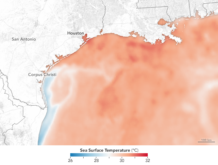
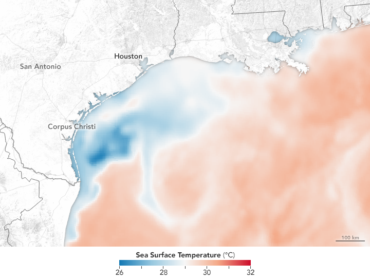
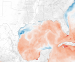
The huge pulse of rainwater and the churning effect of the storm on the Gulf of Mexico has dramatically lowered sea surface temperatures.
2017-08-23 00:00:00
2017-08-30 00:00:00

Hurricane Harvey dropped unfathomable amounts of rainwater on Houston and southern Texas from August 25–30, 2017. The potent category 4 hurricane and long-lived tropical storm also churned up the Gulf of Mexico with its winds and storm surges, dispersing warm surface water and mixing up cooler water from the depths.

All of that falling fresh water and ocean mixing had the combined effect of drastically cooling off the surface waters in the Gulf of Mexico. The maps above show sea surface temperatures in the northern Gulf on August 23 and August 30, 2017. The data were compiled by Coral Reef Watch, which blends observations from the Suomi NPP, MTSAT, Meteosat, and GOES satellites with computer models.

References & Resources

NASA Earth Observatory images by Joshua Stevens, using data from Coral Reef Watch . Story by Mike Carlowicz.
You may also be interested in:

Stay up-to-date with the latest content from NASA as we explore the universe and discover more about our home planet.

Explosive Intensification for Hurricane Polo
5 min read

Several ingredients came together off the Pacific coast of Mexico to generate one of the strongest storms the eastern Pacific…

Article
El Niño Then and Now
4 min read

A 35-year satellite altimetry record lets scientists hold this year's El Niño up against its strongest predecessors.

Article
Powerful Storms Continue to Prowl the Pacific
4 min read

Hurricanes Polo and Nolo sent destructive effects ashore amid an active season in the northeastern and central Pacific.

Article