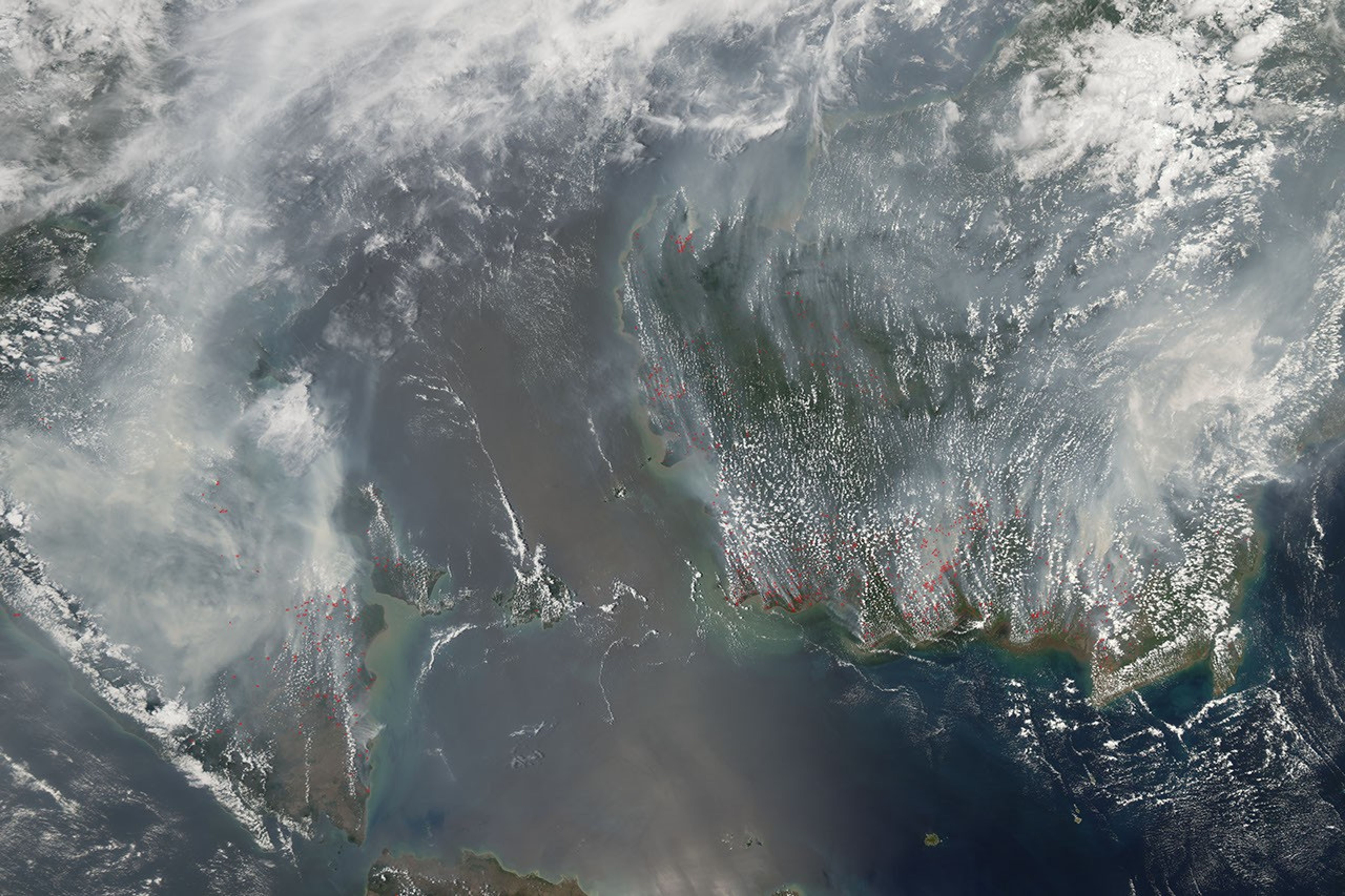
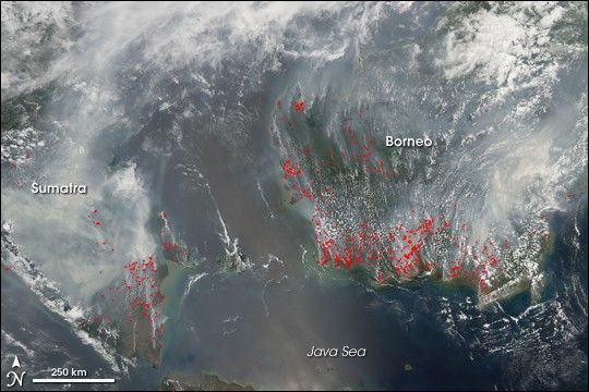
Smoke from agricultural and forest fires burning on Sumatra (left) and Borneo (right) in late September and early October 2006 blanketed a wide region with smoke that interrupted air and highway travel and pushed air quality to unhealthy levels. This image from the Moderate Resolution Imaging Spectroradiometer (MODIS) on NASA’s Aqua satellite on October 1, 2006, shows places where MODIS detected actively burning fires marked in red. Smoke spreads in a gray-white pall to the north.
Despite a governmental ban on open burning, seasonal fires continue to occur on the Indonesian islands each year, peaking in the dry season of late summer and early fall. Slash-and-burn deforestation to clear land for farming or other agriculture still takes place, and fires escape from already cleared land into adjacent forest. The swampy forests of the low-lying parts of these islands sit on thick layers of peat (un-decayed vegetation), which is extremely flammable when it dries out. The peat is exceptionally smoky when it burns.
References & Resources
NASA image created by Jesse Allen, Earth Observatory, using data provided courtesy of the MODIS Rapid Response team.